

Sutherland beaches at risk of being lost within 30 years because of coastal erosion
Register for free to read more of the latest local news. It's easy and will only take a moment.

Some of Sutherland's best-known beaches could be lost within the next 30 years because of rising sea levels, a new study has revealed.
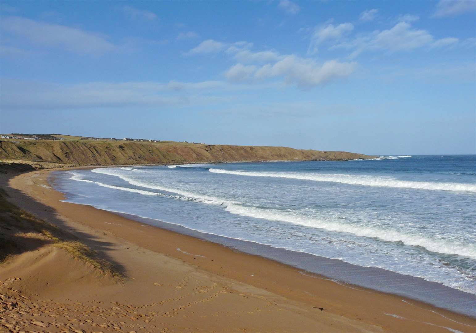
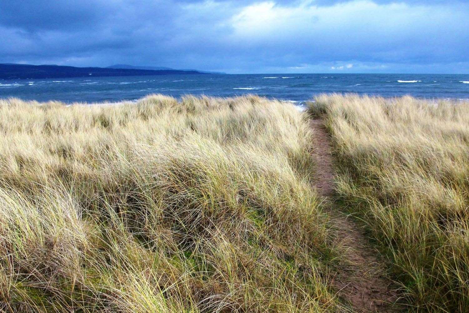
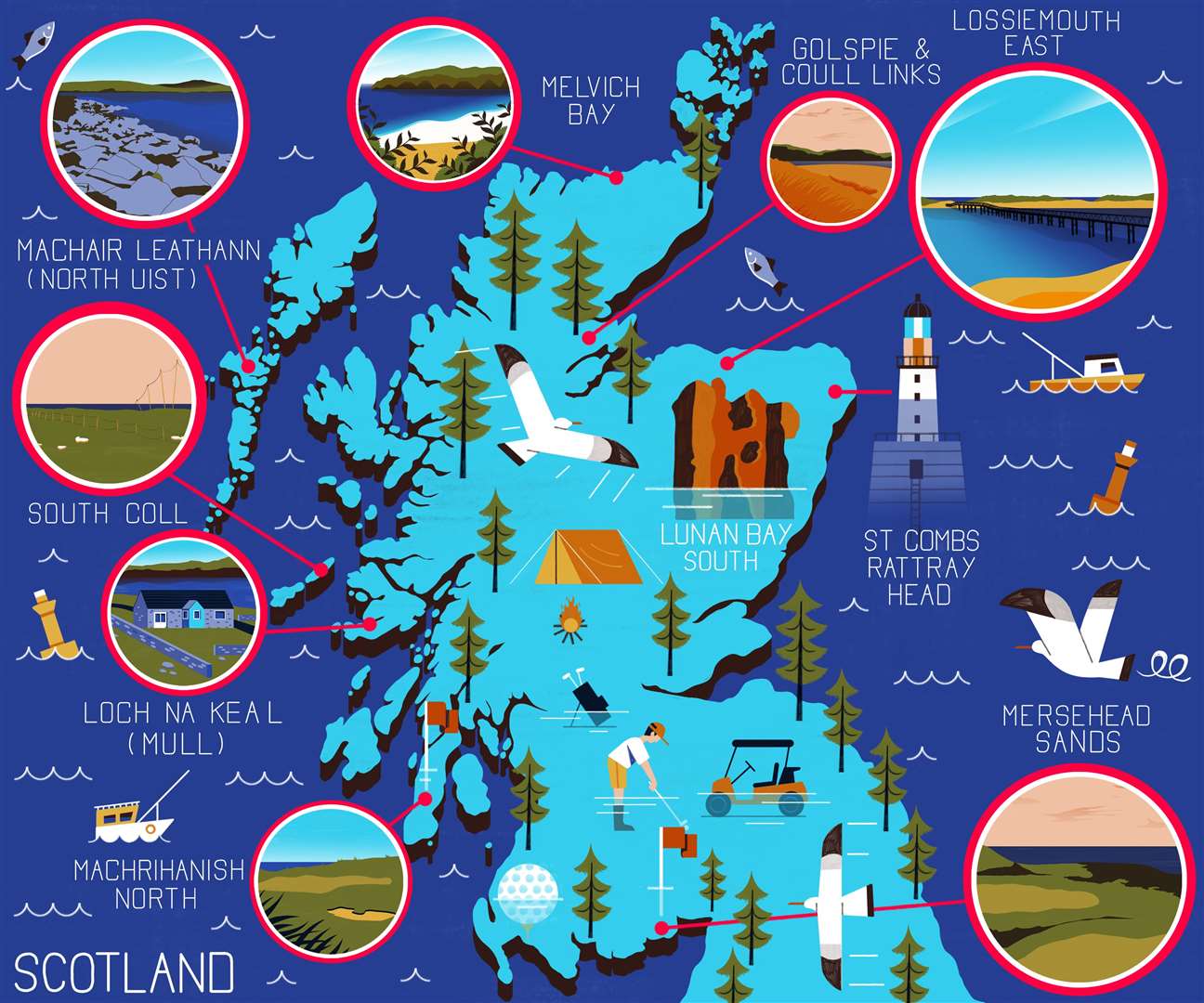
Melvich Bay and a stretch of coast taking in Golspie and Coul Links are featured in a list of 10 areas at risk from severe coastal erosion by 2050.
The locations have been set out on a map following a study by the University of Glasgow.
A professor warned that it was "the tip of the iceberg", with many other areas likely to be similarly affected.
The university undertook a Scotland-wide analysis of coastal erosion risk, including identifying sites that could soon shrink dramatically through the effects of sea-level rise, strong wave action and flooding.
The map was commissioned by outdoor brand Vango as part of its commitment to advancing the UK’s sustainability agenda, helping to raise awareness around the issue of erosion driven by climate change.
The scientifically backed map features some of Scotland’s most renowned wild camping locations.
It is estimated that all of the featured sites will be under increased threat from rising sea levels and extreme weather by 2050 and beyond.
Professor Larissa Naylor, professor of geomorphology and environmental geography at the University of Glasgow, said: “Even with net-zero our sea levels will continue to rise and continue to erode key coastal assets like wild camping beaches and critical transport infrastructure.
"It is thus imperative that we act now to, in the first instance, achieve net-zero and beyond rapidly and, secondly, adapt society to better live with coastal climate change impacts like flooding and erosion.”
Prof Naylor added: “The map is just a snapshot of some of the locations under threat – the tip of the iceberg. Many more sites will shrink in area or disappear in the coming decades, as sea levels continue to rise and climate change impacts accelerate.”


As part of its awareness campaign, Vango has produced computer-generated images depicting an imagined, sunken world beyond 2300. One image shows an underwater camp site and another is of Castle Tioram in Loch Moidart, Lochaber, similarly submerged.
Currently the castle can be reached on foot at low tide but it is expected to be inaccessible from the land by 2100, along with the loss of local wild camping sites along the Ardnamurchan coast.
Mark Beaumont, the Scottish ultra-adventure athlete who holds the Guinness world record for cycling around the world, is a climate action supporter as well as being an ambassador for Vango.
He said: “The map is a stark warning that the issue of climate change, and its impact on our precious outdoors, is very real. The year 2050 is not so far away, especially when I think of the lifetimes of my children and how they can enjoy the great outdoors.
"I would encourage people to get out to these incredible sites – see them, appreciate them, and understand that unless we take collective action they could soon disappear.”
Vango marketing director Rob Birrell said: “Scotland is famous for its scenic wild places and uplifting sense of remoteness, but sadly some of our most beautiful wild camping spots and beaches are seriously at risk and shrinking.
"By sharing this new map, it is our hope that we will spotlight a very real concern about Scotland’s depleting outdoor space – and, ultimately, drive people and politicians to take action now.”
To find out more and to view the map in more detail, visit Vango’s dedicated climate change page.
The top 10 at-risk areas are:
1 St Combs to Rattray Head, on the north-east coast
2 Lunan Bay, Angus
3 South Coll, Isle of Coll
4 Loch na Keal, Isle of Mull
5 Machrihanish, Campbeltown
6 Machair Leathan, North Uist
7 Mersehead Sands, Dumfries and Galloway
8 Golspie and Coul Links, Sutherland
9 Melvich Bay, Sutherland
10 Lossiemouth East, Moray