
Duncansby cliff collapse: 'I would say at least 1000 tonnes of rock has broken away'
Register for free to read more of the latest local news. It's easy and will only take a moment.

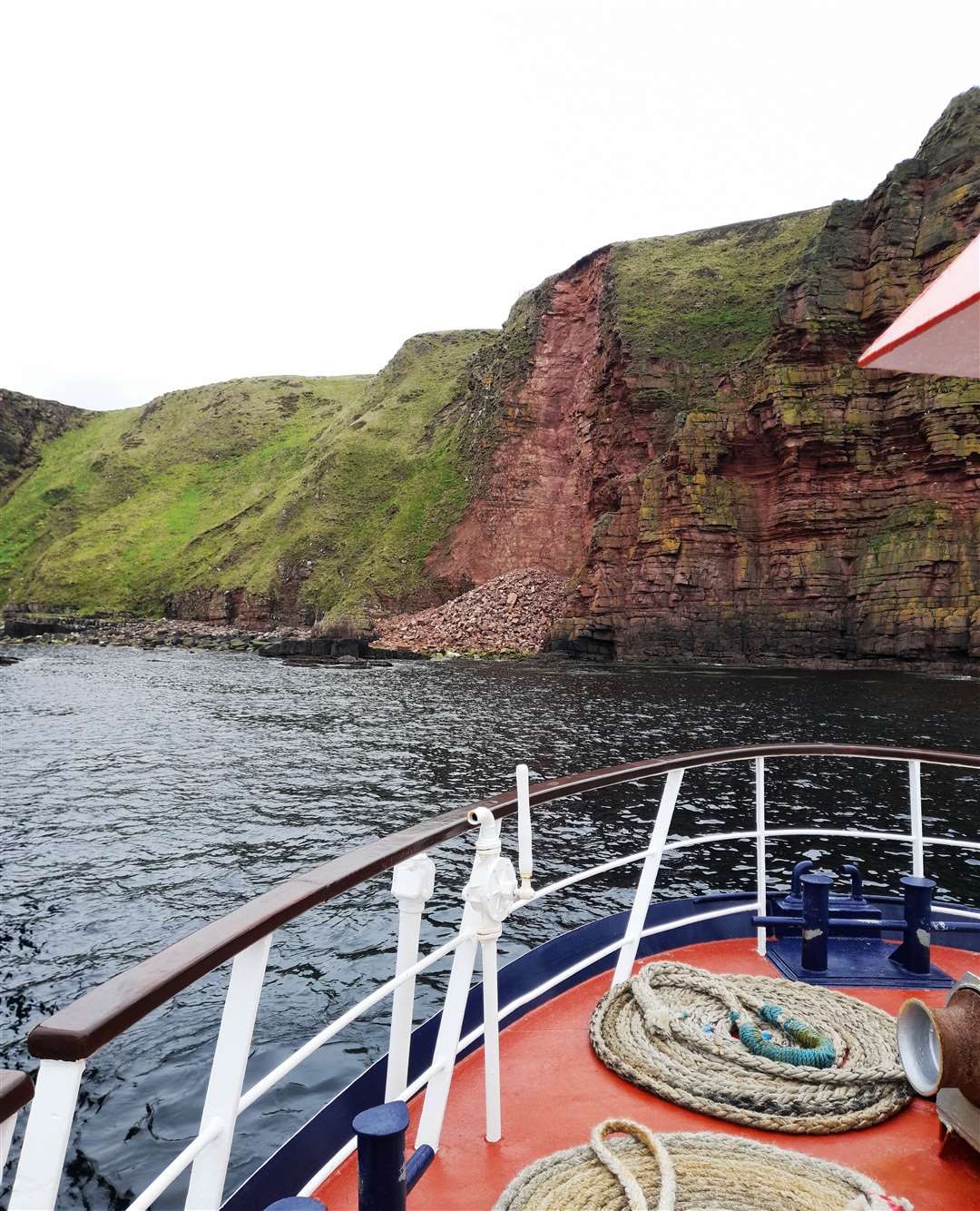
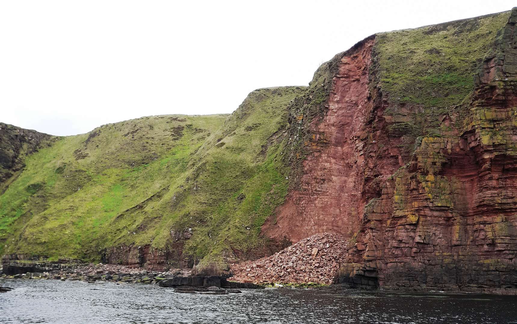
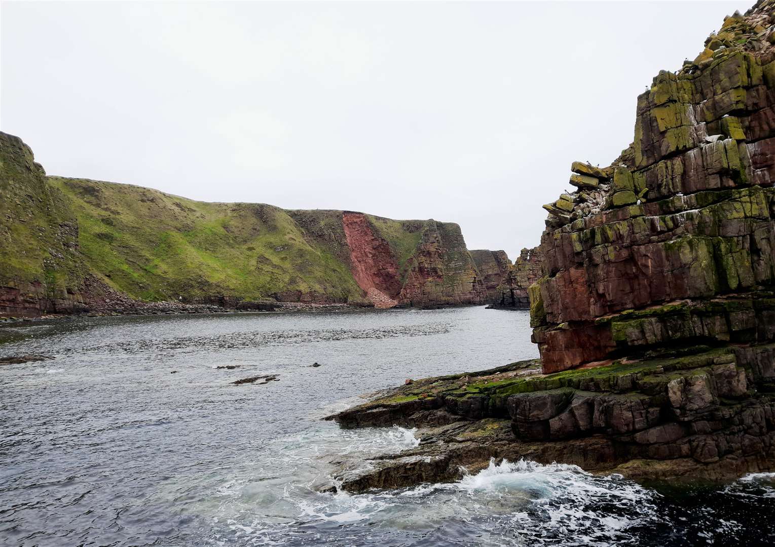
A rockfall at Duncansby Head brought an estimated 1000 tonnes of stone crashing down a cliff-face close to a popular coastal walking route.
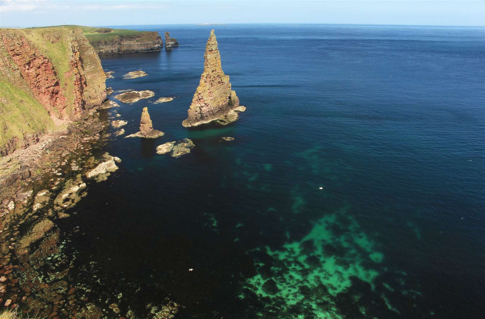
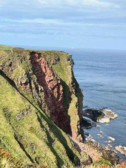
The fall has left a huge gap in the 200ft Old Red Sandstone cliffs across from the famous Duncansby Stacks – and has prompted a warning to walkers that they should keep well away from the edge.
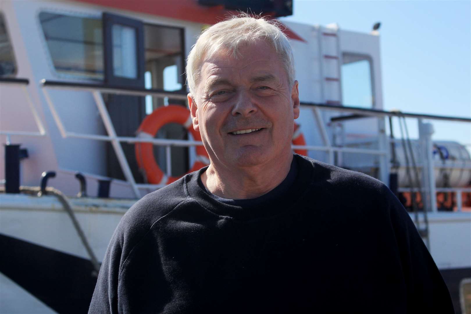
Photographs taken from the sea by skipper William Bremner, of John O'Groats Ferries, show a massive pile of rubble on an east-facing stretch of shore that would be inaccessible by land.
Mr Bremner noticed the rockfall on Thursday while taking the Pentland Venture on its first Duncansby wildlife cruise of the season. He believes it occurred very recently.
The area where the rocks plummeted down is near the Little Stack and a smaller formation known as Tom Thumb.
"I would say it is very recent," Mr Bremner said.
"It's not just vertical, it's actually a slight slope. I would say that at least 1000 tonnes of rock has broken away.
"You can still see turf hanging over the edge so if somebody was standing on that they would fall right through it.
"I do warn people, it's lovely to walk around the cliffs, you can get good views, but be careful – if the grass is wet and you're close to the edge you can slide over. Look at the undercut rocks there – that can go at any time."
Mr Bremner has also seen evidence of a recent rockfall low down on the nearby Muckle Stack.
"We've seen rockfalls on Stroma within the last five or 10 years, and that's much stronger stone," he added.
The Old Red Sandstone dates back 300 million to 400 million years.
The grassy coastal path near the Duncansby Stacks is popular with tourists visiting the John O'Groats area as well as local walkers, and forms part of the 147-mile John O'Groats Trail. Duncansby is well known for its seabird colonies and is an Orca Watch location.
A Highland Council spokesman said: “The land affected is privately owned and is not owned by Highland Council.
"Highland Council is aware of the landslide near to the Duncansby Head core path which is a very popular visitor attraction. The cliff-top is fenced from the general public but if any landslide exposed the users of the core path, or other paths, to an unstable section of ground the council would work with the landowner and the crofting tenants to ensure the area is fenced off as required.”
NatureScot’s Dynamic Coast project manager, Dr Alistair Rennie, said: “Rockfalls such as these are our periodic reminder that even our rocky coasts can change, and that we must take care where we visit the coast. Rockfalls occur often following storms, and they create the dramatic scenery thousands of visitors a year see at the Stacks of Duncansby.
“The Scottish Government’s Dynamic Coast project has been monitoring changes across Scotland’s coast over the last 130 years. While the greatest past and future changes are expected on our beaches, our cliffs are also subject to episodic change.
"The Scottish Government is providing £11.7m of Coastal Change Adaptation funding to local authorities to help them plan ahead, and where necessary fund resilience or adaptation measures, such as moving paths and assets back from at-risk locations.”
NatureScot explained the incident was a rockfall, where there is a structural failure of bedrock, rather than a landslide, which refers to rotational movement of material such as soil.