
Construction of £8.7 million new bridge over the Naver presents 'excellent' opportunity to tackle traffic blight on main north coast road, says community council
Register for free to read more of the latest local news. It's easy and will only take a moment.

Highland Council is being urged to take action to keep residents in a Sutherland village located on the North Coast 500 tourism route (NC500) safe from ”a never ending stream of traffic”.
The local authority is being asked to significantly extend the speed restriction through Bettyhill amid fears an increase in vehicles using the A836 is putting inhabitants at risk.
The appeal by Bettyhill, Strathnaver and Altnaharra Community Council comes as NC500 was named as the most dangerous of the UK’s popular driving routes in terms of the number of accidents (307) between 2016 and 2020.
Community council secretary Jim A Johnston said: “The NC500 promotion, plus increased economic activity to the west of us and continuing forestry extraction all year round has unleashed a never ending stream of traffic through all the string of settlements along the north coast and action is required to keep our people safe.”
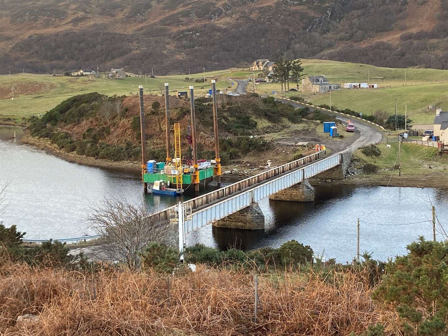
The community council believed the construction of a replacement bridge over the River Naver near Bettyhill, preparatory work on which is under way, presents an “excellent” opportunity for the local authority to review traffic management through the scattered village
A planning application for the £8.7 million new structure - described as a “huge investment” for the north coast, was submitted in December and is currently under consideration with a decision expected in April.
The outline design of the 84metre long, double carriageway, steel and concrete bridge has been finalised between Highland Council and Fairhurst Consultancy.
Topography surveys have been carried out along with ground investigation. Last month a jack-up drilling rig was deployed to enable the river bed to be studied more thoroughly.
A substantial lay-by is planned on the approach to the bridge, giving views across the Naver estuary to the sea while, on the western approach a turning and parking areas is to be provided.
The community council called for a new traffic scheme when it gave its views on the bridge planning application in a written submission to Highland Council, made on January 24.
It stated: “We think that the building of the new bridge presents an excellent opportunity for Highland Council to consider traffic management along the whole length of the A836 through the village.
“We believe there is a strong case for a speed limit to be imposed along this entire length, especially in the area from the western cattle grid to the 30mph zone starting at the Bettyhill Hotel, but also at the eastern end from the cattle grid at Fiscary to the start of the present 30mph limit at Clachan.”
While saying it is “very pleased” with the intention to build a new bridge, the community council is concerned about pedestrian access to the structure and wants confirmation that lengthy footpaths will be provided on either side as well as across the bridge.
It also wants to see construction traffic routed via Thurso, access to the western bank of the river from the approaches to the bridge to be retained, and it wants to be consulted about signage on the approaches to the new bridge.
And it stated: “Within the last 500 metres or so of leading up to the proposed bridge approaches, there are several houses whose occupants have already complained about the danger to pedestrians caused by the high speed traffic of all shapes and size,s such that they are afraid to walk from house to house.
“We have been told that a Levelling Up fund exists and would suggest that this section of road would be a very good place to apply it.”
A list of the UK’s most hazardous driving routes was drawn up by online auto trader specialist We Buy Broken Vans who collected data from the Department of Transport, including information on Road Safety Data for Accidents from 2016-2020.
These results were added to a data visualisation software, which added the information to a map of the UK.
Using the RAC’s recommendation for the start and end point of each road trip, We Buy Broken Vans, mapped out each road trip to determine which route was the most dangerous road trip in the UK.
The 516-mile NC500 came top in terms of total number of accidents but dropped into ninth spot by dividing the number of accidents by distance.