
Bonar Bridge man's 1892 land letter to lawyer
Register for free to read more of the latest local news. It's easy and will only take a moment.

COLUMN: From the Highland Archive Centre
In the late 1800s and early 1900s, land was increasingly becoming a bone of contention in Sutherland and across the Highlands.
Landowners were restricting crofters’ access to common grazings land, which crofters used for grazing their stock and as a source of building materials and fuel.
This was one of the factors that ultimately led to the formation in 1909 of the Highland Land League, which campaigned for fairer rents and more secure tenures for crofters.
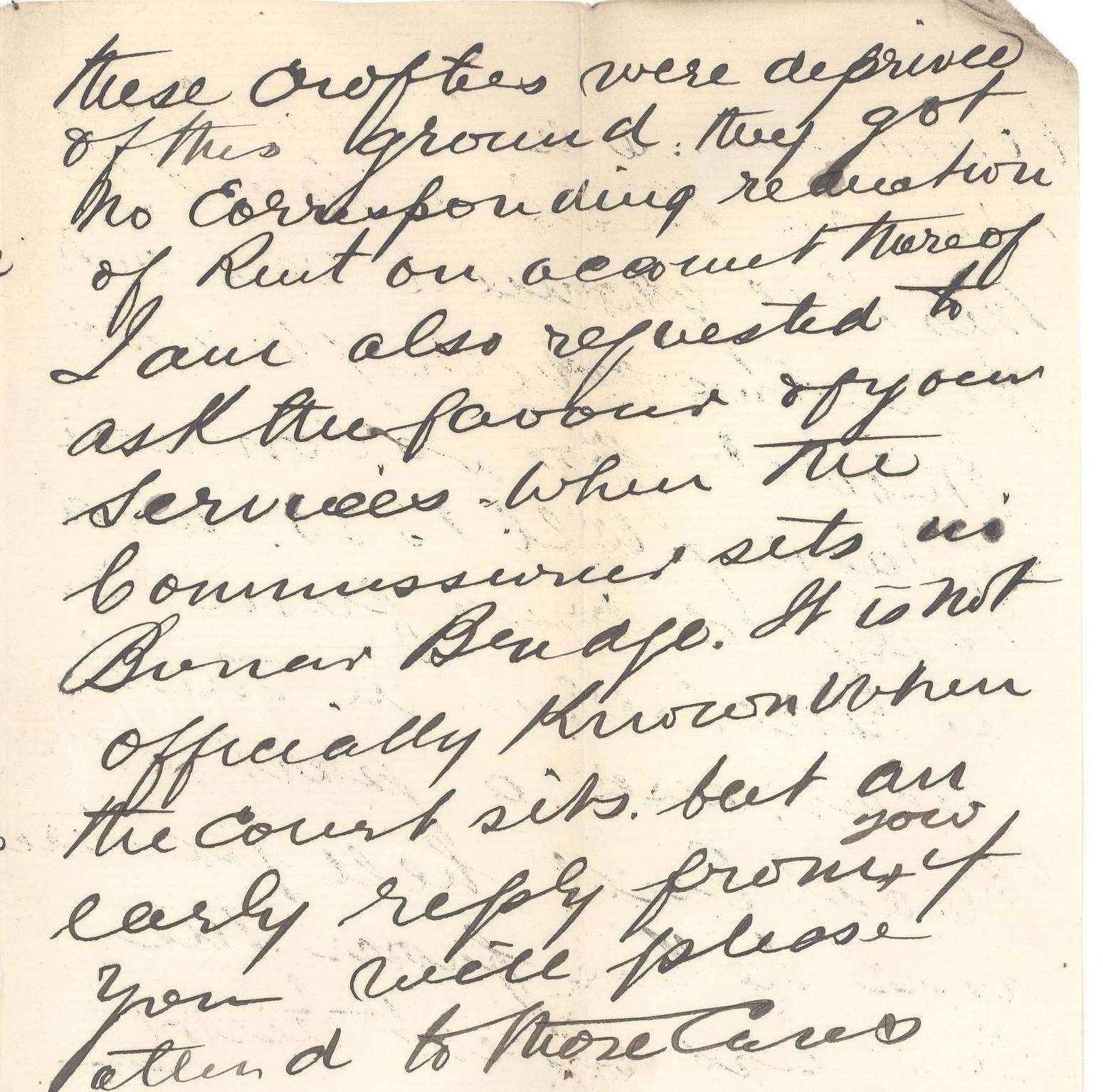
One Bonar Bridge resident mentioned his concerns over land issues in a letter dated May 4, 1892, to his Inverness solicitor.
Alex Mackay wrote: “One thing is clear, when these crofters were deprived of this ground, they got no corresponding reduction of rent.”
The letter is one of the many fascinating items of correspondence linked to the parish of Creich held by the Highland Archive Centre. These also include school log books, poor relief records and early censuses.
Creich is the latest and penultimate stop in the virtual tour this column has been taking of the 13 parishes in Sutherland.
A substantial parish, Creich lies on the north side of the Dornoch Firth and extends about 30 miles in a south-easterly direction from Benmore-Assynt to within just three miles of Dornoch.
In contrast, its breadth ranges from some two to 10 miles.

The origin of the name Creich was not known in the First Statistical Account of the 1790s.
But it is thought that it may come from the Gaelic “croich” meaning boundary, as the parish serves most of the boundary between Sutherland and Ross and Cromarty.
However, it is also suggested that Creich might mean “the parish of woods or trees” from the Gaelic “craobhach” meaning wooded.
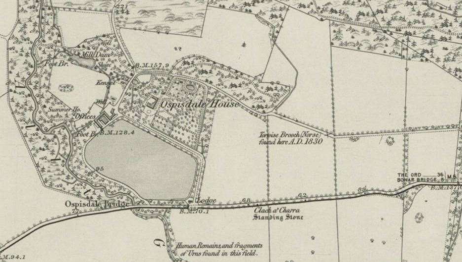
Interesting information regarding a standing stone in Creich is to be found in an Ordnance Survey Name Book - created in conjunction with the First Edition Ordnance Survey maps in the 1870s.
The stone in question is about 10ft high and situated on the public road to Dornoch nearly opposite Ospisdale House.
The entry states that according to tradition a “Danish chief was shot here by the laird or proprietor of Ospisdale and interred here”.
However the entry also states that it was thought by the Reverend Mr Joass, Golspie, to probably be a memorial of an early battle. He pointed out that a Norse tortoise brooch had been found at the site.