
ACTIVE OUTDOORS: Step into the past at Whaligoe and Cairn O’Get
Register for free to read more of the latest local news. It's easy and will only take a moment.

Caithness has a long history that perhaps deserves to be much better known. It’s true that places like the Whaligoe Steps are not the secret they once were, but there’s so much to discover just a hop and a skip off the A9 or A99 – and that’s before venturing deeper into the rest of the county.
Last time I was zooming up and down the road from Inverness, I stopped off at Badbea to visit the Clearance village above steep cliffs, where the community was walled off from any better land further inshore.
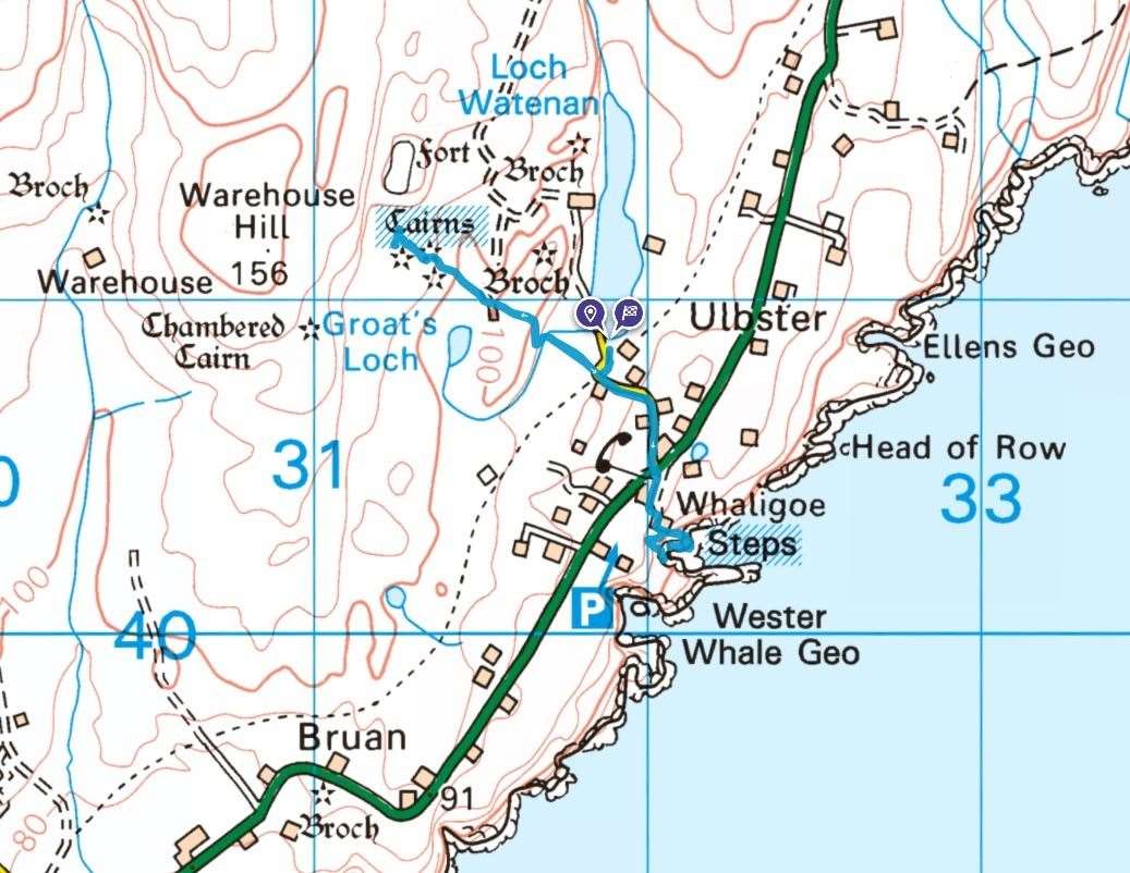
This time I wanted to pay another visit to the steps, and it’s quick enough to include a walk to the burial chamber at Cairn O’Get at the same time. In fact, it makes it easier to find the starting point, as that attraction – looked after by Historic Environment Scotland – is signposted from the A99 just south of Ulbster, about eight miles south of Wick.
A small layby at the end of the dead-end minor road provides parking at the foot of Loch Watenan. If you want to get some sort of idea of the importance of this place to ancient people in this area, just look at the large-scale OS Explorer map – it’s covered in chambered cairns, remains of brochs, stone rows, cists, a large fort, standing stones and hut circles.
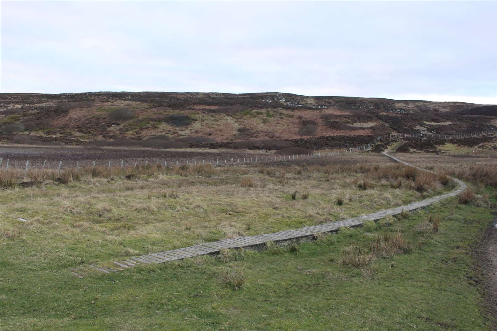
The walk starts at a gate beside a clear sign for the Cairn O’Get, which tells you to follow the black and white marker posts to reach the site, and also warns of livestock in the fields. There was none on my visit, thankfully, so I followed the sometimes boggy path that passes a ruin and then climbs a little hill.
Route details
Cairn O’Get and Whaligoe Steps
Distance 2.5 miles / 4km
Terrain Minor road, path through croft land, boardwalk, steep steps with precipitous drops, cliff-top path
Start/finish Small parking area for Cairn O’ Get (signposted), on minor road off the A99 south of Ulbster
Map OS Landranger 12; OS Explorer 450
A stone age burial chamber and a remarkable set of stone steps just a stone’s throw from each other
Click here to view the route in OS Maps
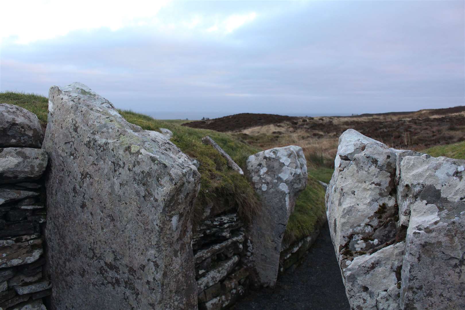
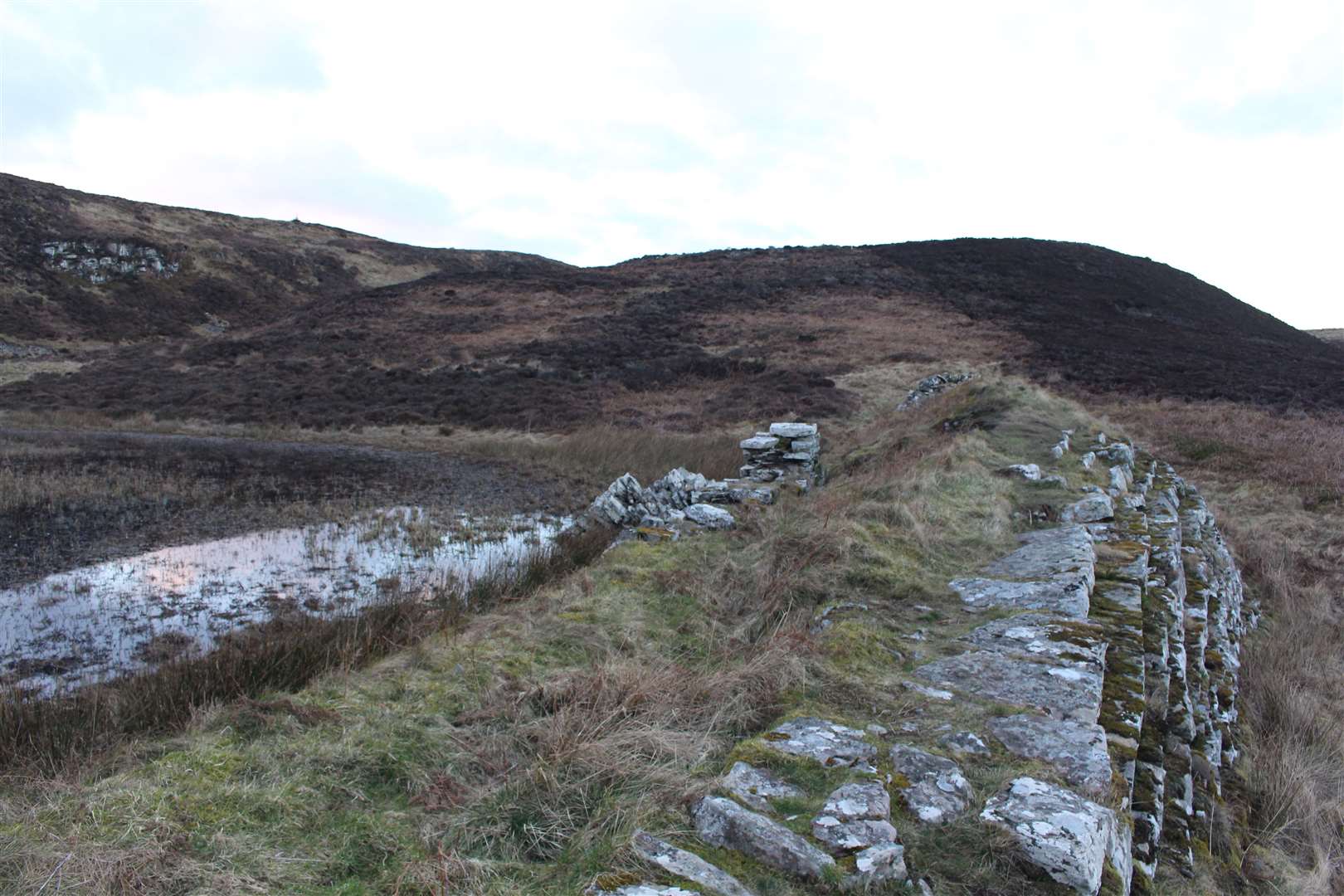
After another gate, a boardwalk follows a marshy area to the north of Groat’s Loch, then there’s another little rise before you reach the 5000-year-old cairn itself. This would have been built by the first people who farmed in Caithness, and it is believed to have been used as a place where they connected with their ancestral spirits.
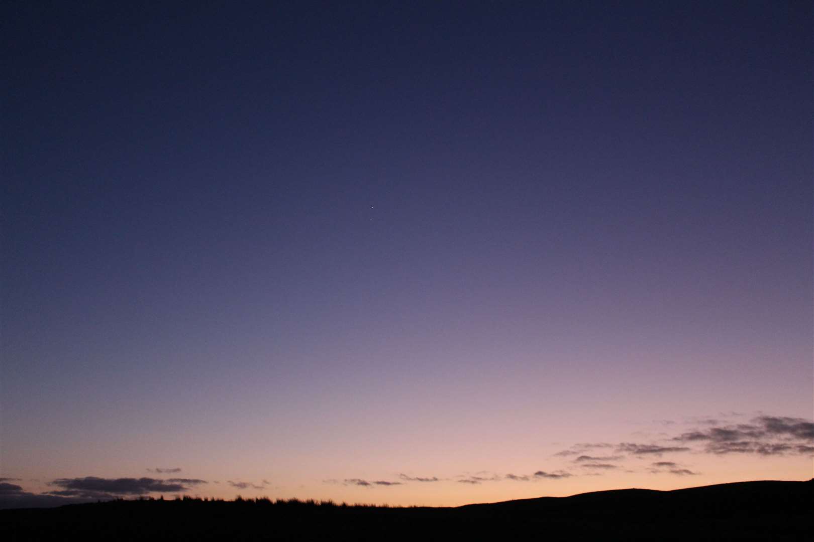
I wandered over to a nearby dam, built with stone taken from the cairn in the 19th century, before making my way back in the evening twilight through this quiet and eerie landscape. I wanted to get down and back up the Whaligoe Steps before the light faded completely.
Back at the road, I followed it to the A99, which must be crossed with care, then followed the road opposite past a row of houses. To access the top of the steps, turn left just before the little car park at the end (there are only a few spaces here, as some are for residents) then follow the path round the side of the house.
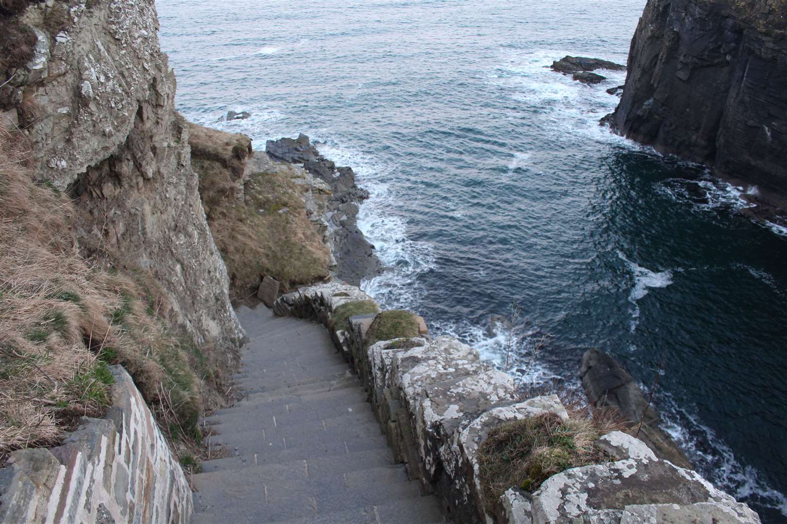
The 365 steps were made in the 18th century and lead down to the Bink, a man-made flat area where the fisherwomen would gut the fish and carry them up to the top of the cliff in baskets, before walking the eight or so miles to sell them in Wick.
The small inlet had around 20 local boats and others would visit, bringing in their catch of haddock, cod, herring and ling. The remains of a building on the Bink is the old salt store and the house at the top is the old cooperage where barrels were made to store salted herring which was taken away by schooner.
The walk down the steps is steep and not for the feint-hearted. A lot of repair work has gone on recently, though towards the bottom some of the remaining 337 steps are loose and need extra care.
Local man Davy Nicolson has worked on the steps for a long time, as well as showing people from all walks of life this monument to past lives in the county, while the late Etta Juhle cleared tons of rubble single-handedly in 1975 after a landslip. Davy spoke to Wick Voices in 2017 and his stories make for fascinating listening still.
Climbing back up the steps, I took a slight detour at the top to follow the cliff-top path around to a viewpoint, from where you get a better view of the full set of steps, and a better understanding of the hardships people here used to endure to earn a meagre living.
Returning to the Cairn O’Get road, the last of the light was hiding itself away below the horizon as the stars and planets began to shine, just as they had done thousands of years ago when these lands were so different.