
ACTIVE OUTDOORS: Skye shelter has perfect lookout
Register for free to read more of the latest local news. It's easy and will only take a moment.

Andy Dixon finds he is disturbing the peace on a family walk to the northern tip of Skye – where he discovers a stunning vantage point
Visiting Skye is always a good idea. It might not always feel like it though.
Heading from Inverness, we thought we’d go via the A82, but we got as far as Lochend then turned around because an accident had closed the road. Our alternative route took us via Dingwall, adding about an hour onto a journey that was already likely to take at least two-and-a-half.
Our destination was Staffin, to stay with a friend and his family. Extra time due to the route change was compounded by Skye’s ability to attract campervans and bikers. The former were slow and steady, the later were swift and less predictable in comparison. You have to be alert if making this journey – and that’s not even mentioning the patchwork road surface with a dot-to-dot of potholes or the single-traffic lanes.
All this is worth it because of the rewards Skye has to offer in terms of natural beauty.
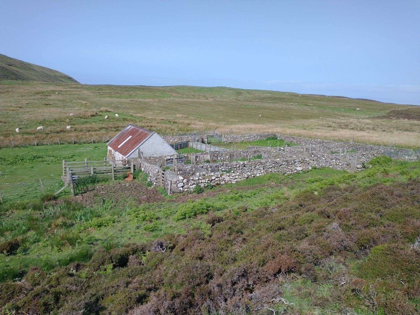
Our friends’ croft stretched toward the beach with views of the Western Isles in one direction and Wester Ross in the other.
Open to the elements, it was beautiful regardless of the cold wind and light rain on our first day – conditions that were not appealing to your fair-weather adventurer.
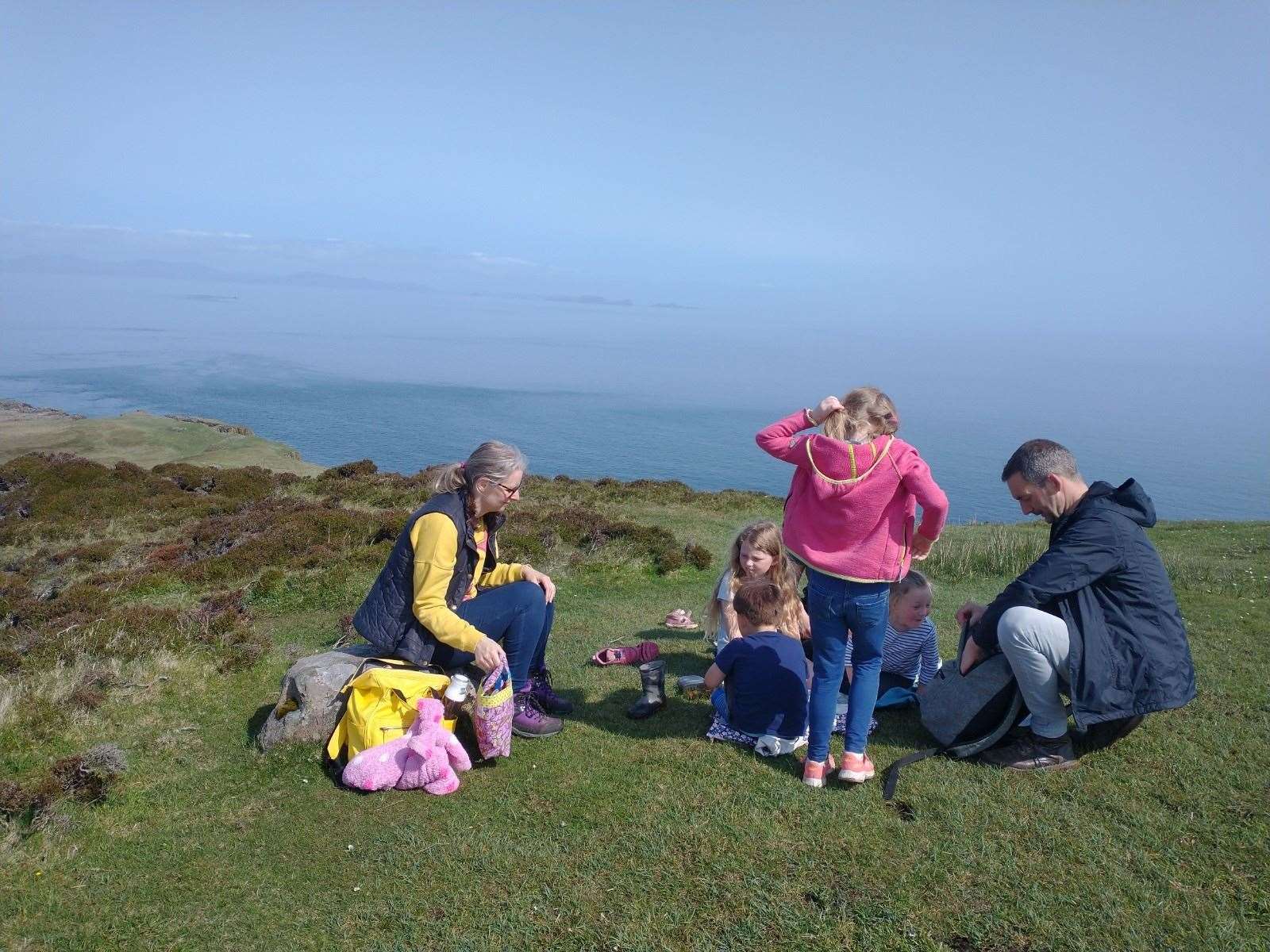
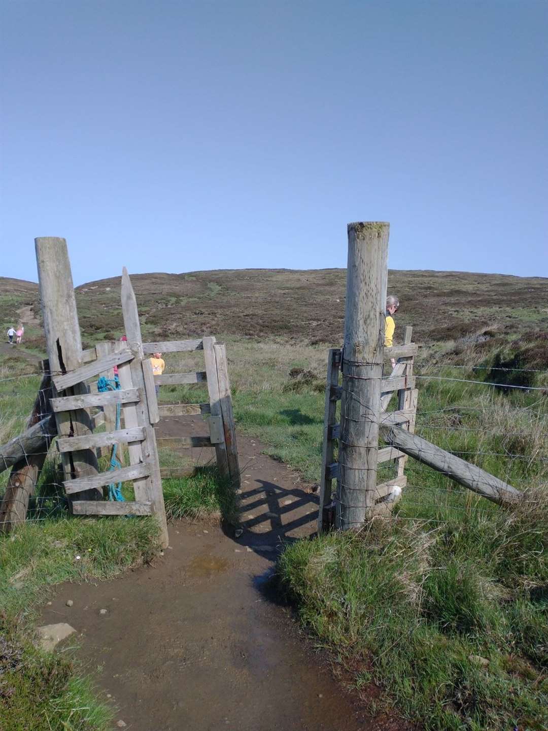
So after an evening of indulgence and catching up, we all had a big breakfast before hitting Rubha Hunish – a 2.5km countryside trek to a lookout bothy on the north of the island.
It might not sound like much but there were eight of us, with half of our number being seven years old or younger.
We were fully loaded with sweets, juice, water, sun cream, plus our picnic as we took to the well-marked dirt path sprinkled with rocks of all shapes and sizes.
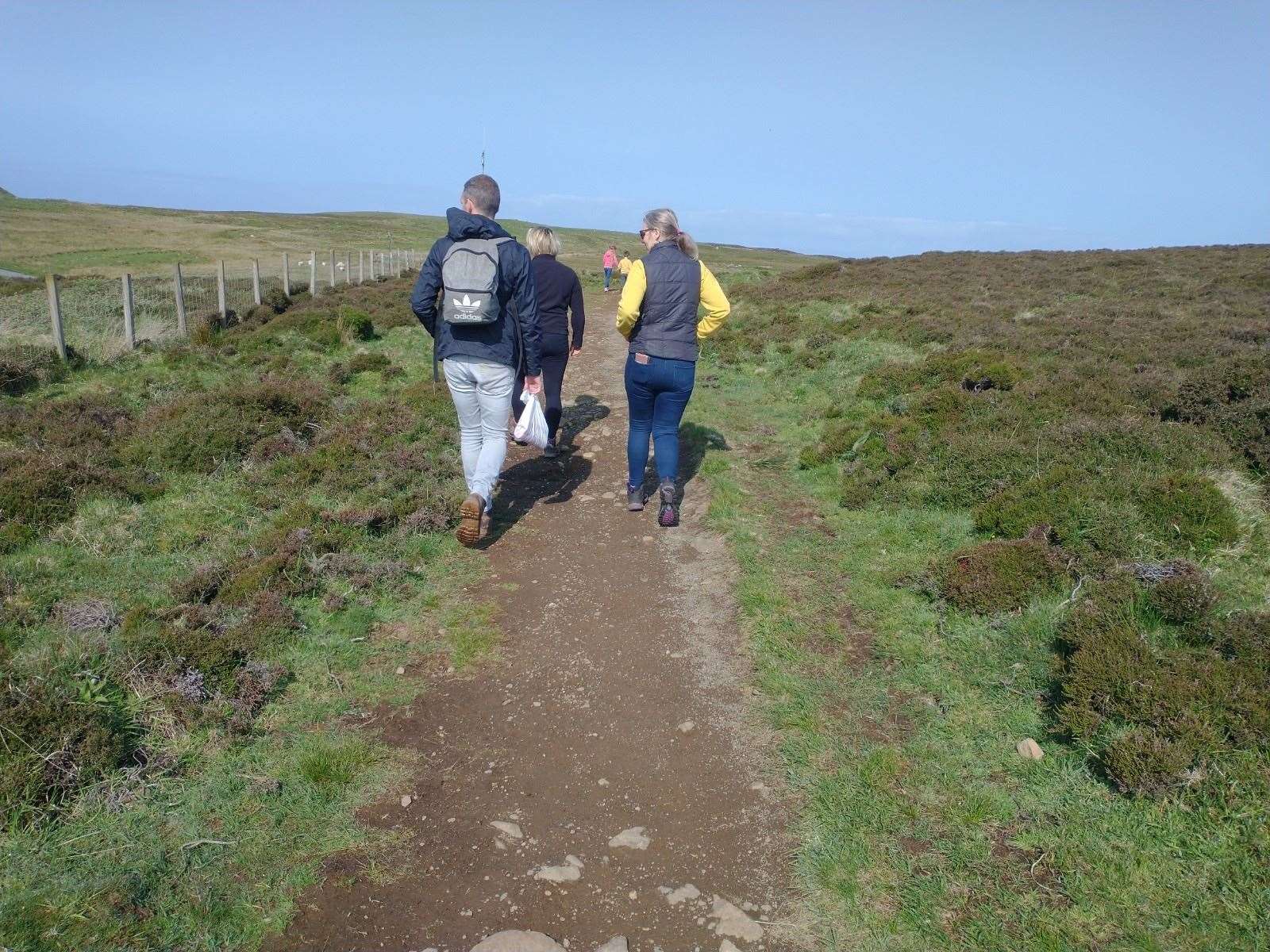
The car park, just off the A855, indicated it was a popular route and there were seldom moments where we couldn’t see another person that wasn’t part of our gang.
These other visitors were probably looking for peace and serenity, but that was broken by us – especially the youngsters.
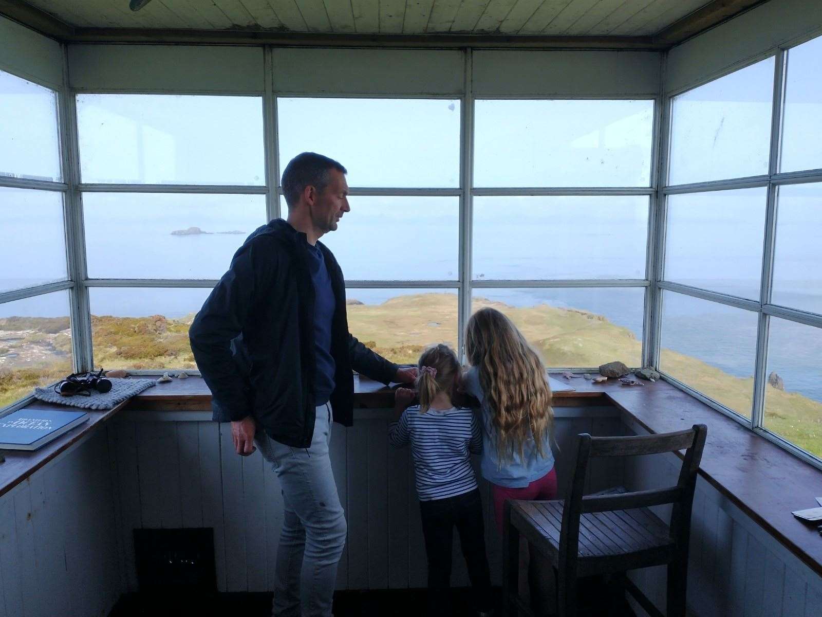
Switching between dirt tracks, grass, stone steps and styles, we ascended gradually toward the Lookout. Inside was a room with bunk beds, a makeshift kitchen area and the main room with panoramic views of the ocean.
A sign stating “dream destination” was above an inside doorway and there was a mixed selection of books and magazines available, along with a guest book.
According to Walkhighlands, it was used for overseeing the Little Minch, an important shipping channel. Previous visitors had left an array of goodies including porridge sachets, vitamin tablets, tea bags and soy sauce.
Although it looked wind and water tight, it’s unlikely to be somewhere I’d stay unless I lost a particularly bad bet with friends.
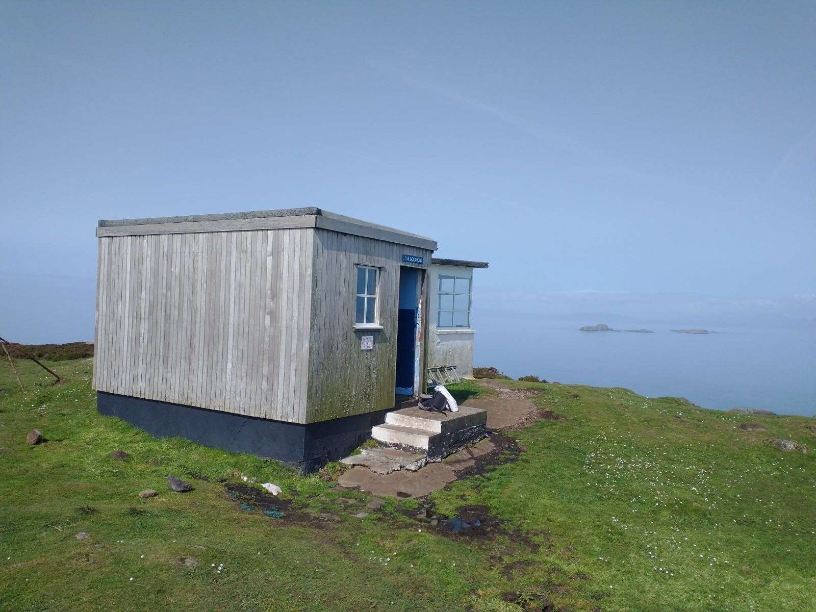
The setting, though, was magnificent. We sat outside and ate our cheese and salad sandwiches, crisps, fruit and rice cakes while using an app to identify which boats we could see operating in front of us.
It took about an hour to get here, we explored the Lookout again then set off from whence we came after our 45-minute interval.
Mostly downhill toward the car park, we arrived back around 40 minutes later, with the only real delay being when one of the youngsters tumbled over and cut their knees, hands and abdomen on rocks. A Curly Wurly was the perfect treatment to stop the tears.
Perhaps not a walk we’ll repeat any time soon, getting the chance to recharge on Skye balanced out any frustrations encountered with traffic on the way back to Inverness.
Route details
Rubha Hunish, Skye
Distance 2.75 miles / 4.5km
Terrain Clearly defined dirt path
Start/finish Rubha Hunish car park, A855
Map OS Landranger 23; OS Explorer 408
Disturbing the peace on a family walk to the northern tip of Skye
Click here to see the route in OS Maps.