
ACTIVE OUTDOORS: Looking into the abyss at Evanton's Black Rock Gorge and community wood
Register for free to read more of the latest local news. It's easy and will only take a moment.

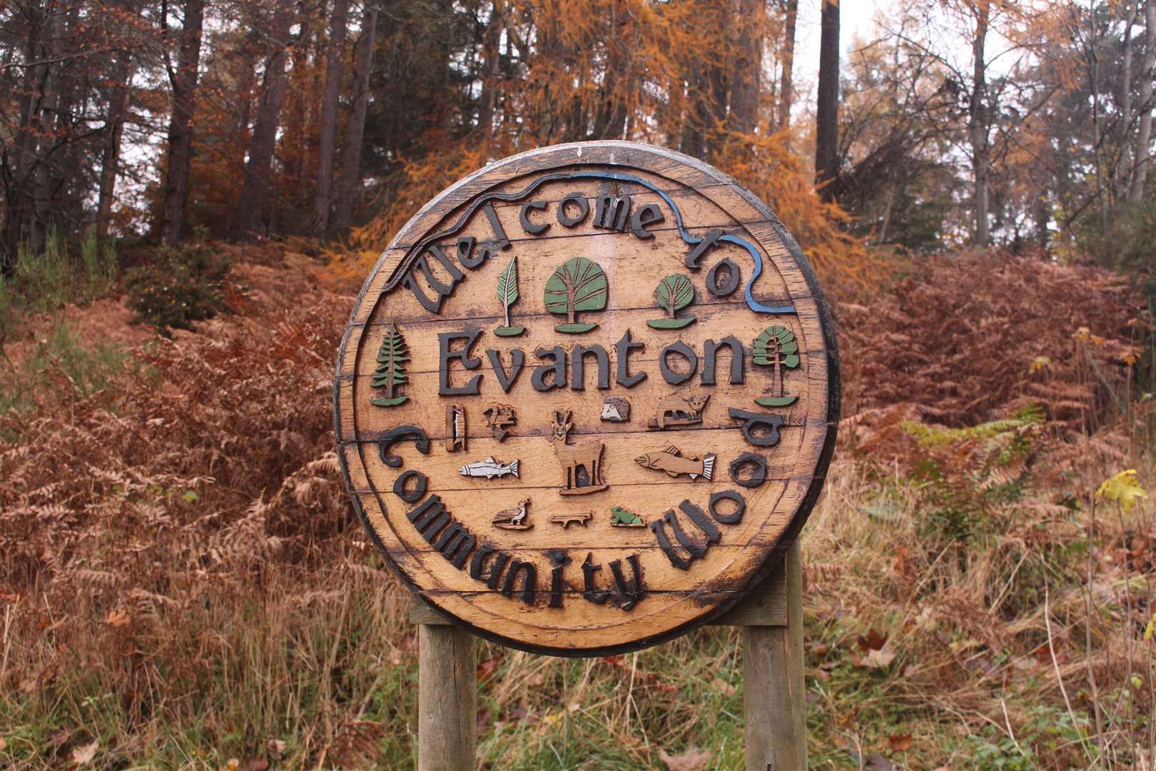
A little over 11 years ago, the local community took ownership of the beautiful woodland at Evanton. Even before then, the management of this special place was more forward-thinking than you might have thought.
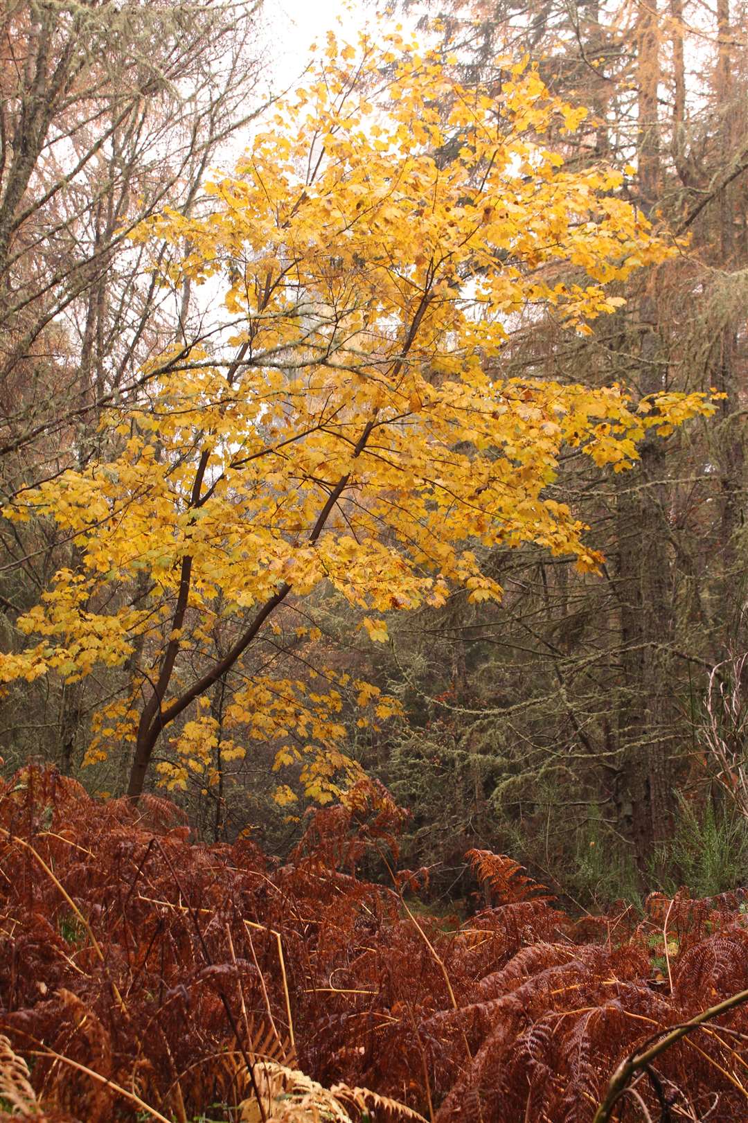
There is a wonderful mix of trees and colours here, just a short stroll from the centre of the village. From towering Douglas firs to magnificent willows, beeches and birches, there is always something different around the next corner.
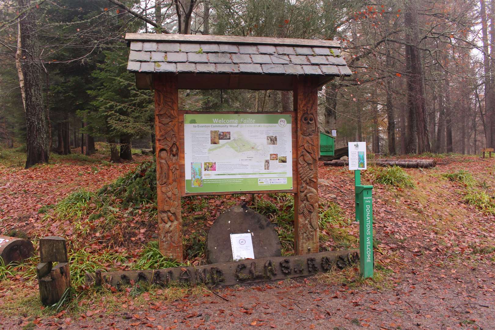
Unlike many plantation woodlands, there is space beneath the canopy and a walk here is a wonderful way to spend some time. There’s even a huge children’s play park complete with Nessie figure close to the start of the trails, which are marked on a large map board at the main entrance to the woods.
With six miles of paths to choose from, there is loads to discover, and you can wander on everything from wide tracks and clear paths to narrower routes between the trees.
Of course, one of the main attractions here is the spectacular Black Rock Gorge, scene of many a reputed “giant leap” including by local man David ‘Grove’ MacDonald in the late 19th century, who is said to have made the jump for a bet.
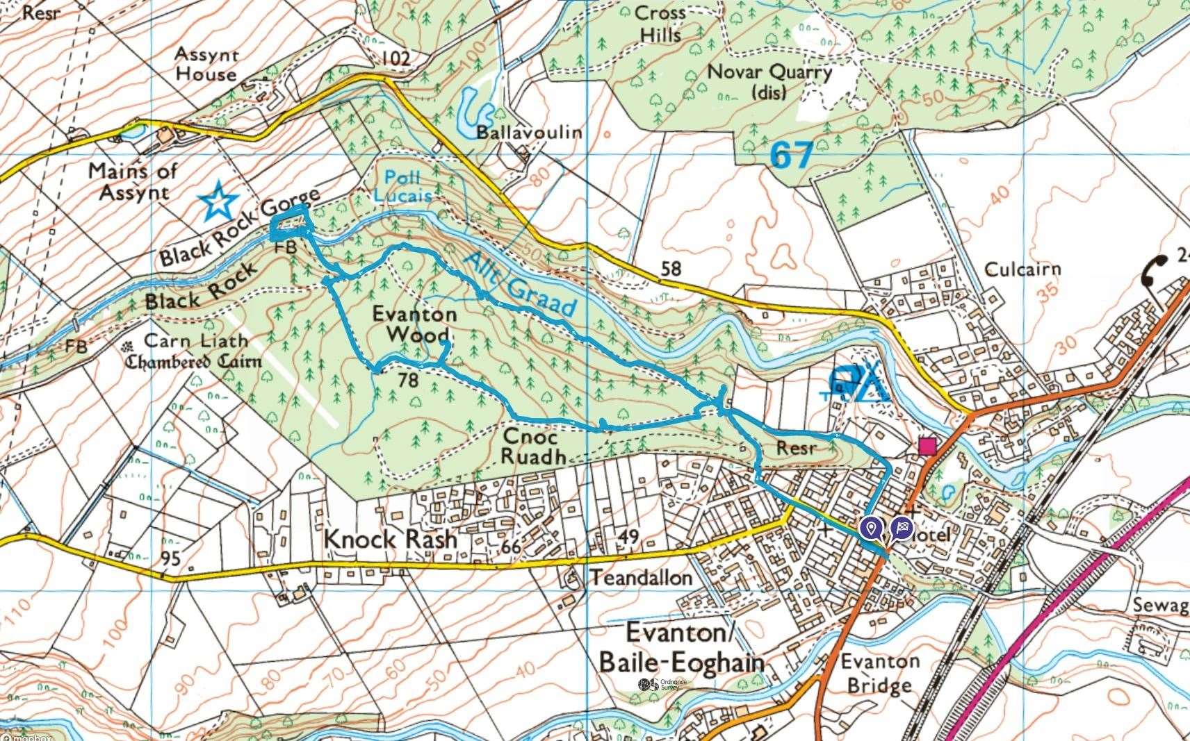
Having followed Castle Road from the car park in the centre of the village, I turned right along Camden Street, which is signed to Evanton Woods and the Black Rock Gorge. The road bends left at the end and continues as a track to a gate, which gives access to the community woodland. Head straight on, through the gate, and follow the track to reach the starting point for the main trails.
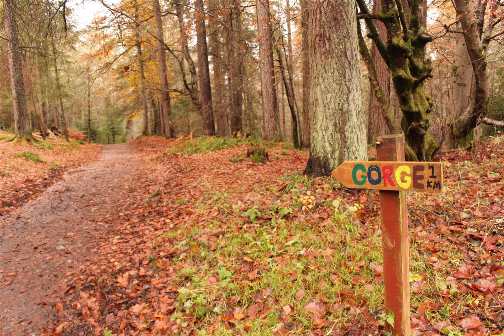
There’s a circular route marked to the gorge bridges, which I decided to follow, although only one of the bridges is in use at the moment. The route begins by heading to the right of the play park and is clearly signed by a couple of colourful arrows.
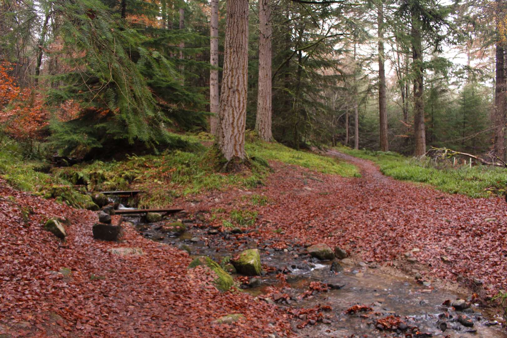
It was wonderfully peaceful as I walked along the track on a bed of soft fallen leaves, the sounds of the birds in the branches giving voice to the woodland. Below, the Allt Graad was billowing downhill to reach the sea at the Cromarty Firth.
After a while the path crosses a burn via a ford – or you can use a plank across the water behind a carved bench with hedgehog sculptures on it. The path then climbs higher above a steep drop that leads down to the burn, with a viewpoint through the trees at one point.
The different colours of the autumn leaves, needles and barks was soothing for the senses, despite the overhanging gloom of the mist lurking between the trees.
Soon I came to a path marked down to the right for the “Gorge Bridges”. I followed it downhill to the first bridge and walked partway across, staring deep into the chasm below.
A scene for the Harry Potter film, The Goblet of Fire, was recorded here in 2004. However, its natural wonder is astonishing enough itself. The vertical sidewalls of the gorge drop menacingly into the darkness, their curves and hollows etched out over centuries of powerful water pummelling away at the rock.
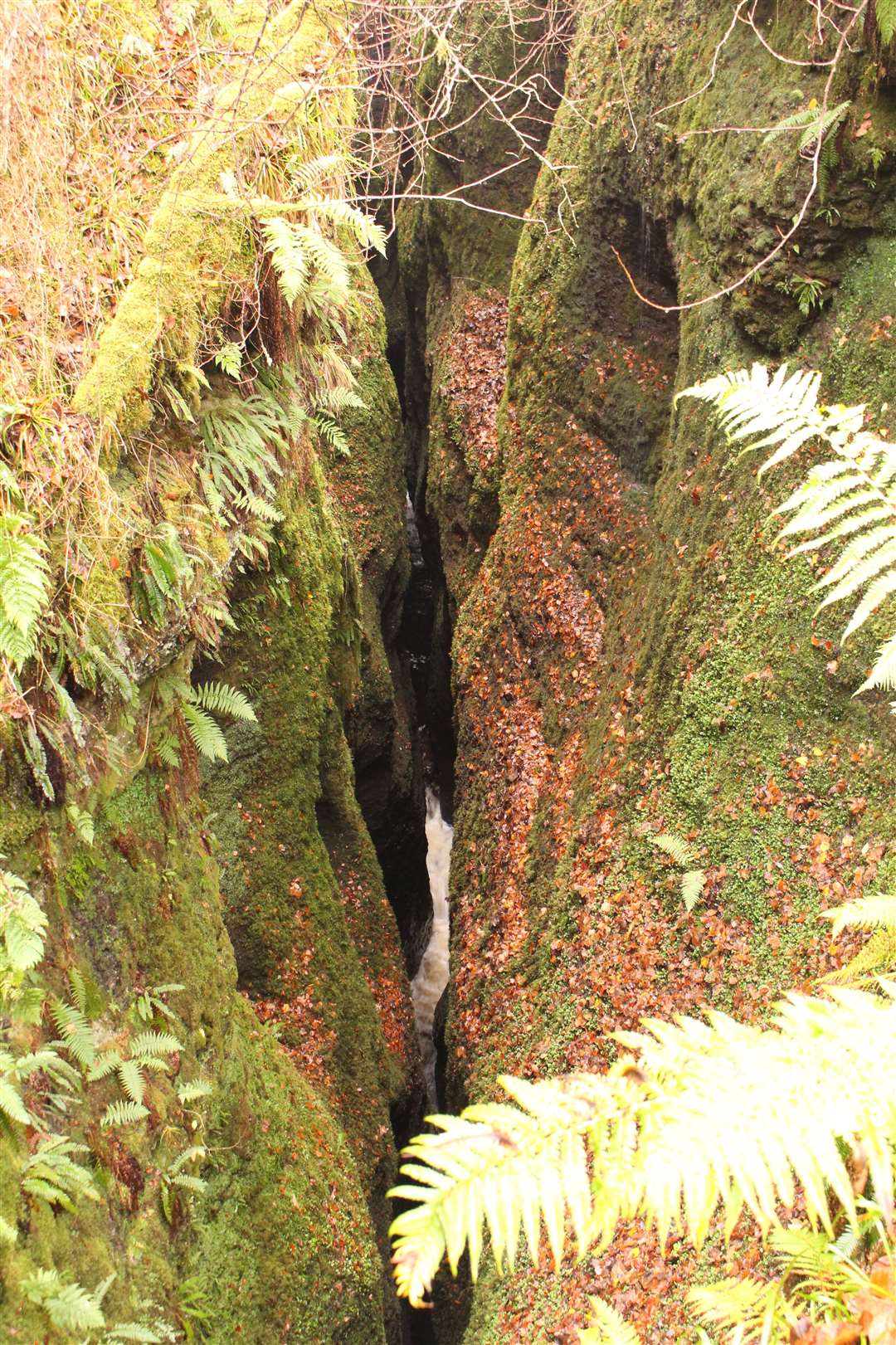
The water itself is just visible here and there, and the sound echoes up through the gorge to a powerful roar.
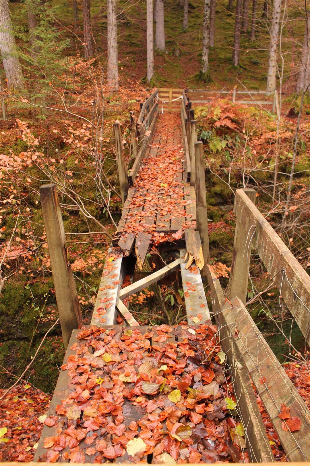
I crossed and took the path ahead then left to reach the second bridge, although this one has been seriously damaged and is blocked off as it is not safe to use. Returning to the first bridge I crossed back and explored a little further before heading back up to the main track.
Turning right, I continue my circular walk, taking a left turn a short way ahead opposite some simple wooden benches. This path leads downhill to the Upper Pond, where you cross the outflow before reaching a junction.
Go left here to continue the route, which passes close to the Lower Pond but continues past that turn-off to reach a T-junction. A left turn here leads past the Balconie Well back to the start of the trails.
My route only explored some of the main paths in the woodland, which has a fascinating history that you can find out more about at www.evantonwood.com or, better still, by visiting for yourself.
Instead of following the track back out, I took a path to its right, signed for the chapel, to emerge at the top of Chapel Road and then back to the village centre after a refreshing and peaceful walk.
Route details
Evanton Community Wood and the Black Rock Gorge
Distance 3 miles / 5km
Terrain Woodland tracks and footpaths; care needed near gorge
Start/finish Evanton village car park
Map OS Landranger 21; OS Explorer 432 or 438; Evanton Community Woodland map
A walk through a beautiful community woodland in Ross-shire with a visit to the impressive Black Rock Gorge
Click here to see the route in OS Maps