
ACTIVE OUTDOORS: Heading upriver on Wick walk full of wildlife
Register for free to read more of the latest local news. It's easy and will only take a moment.

Arguably some of the most dramatic scenery in Caithness is to be found along the coastline, but step inland and there’s still plenty to discover.
The area is well known as a centre of Iron Age activity, with remains of brochs, chambered cairns and other features that can be explored.
And even away from the county’s highest hills, Scaraben and Morven, there are walks to spark the imagination, and this gentle wander from the centre of Wick gives access to a lovely peaceful riverside with an abundance of wildlife to look out for.
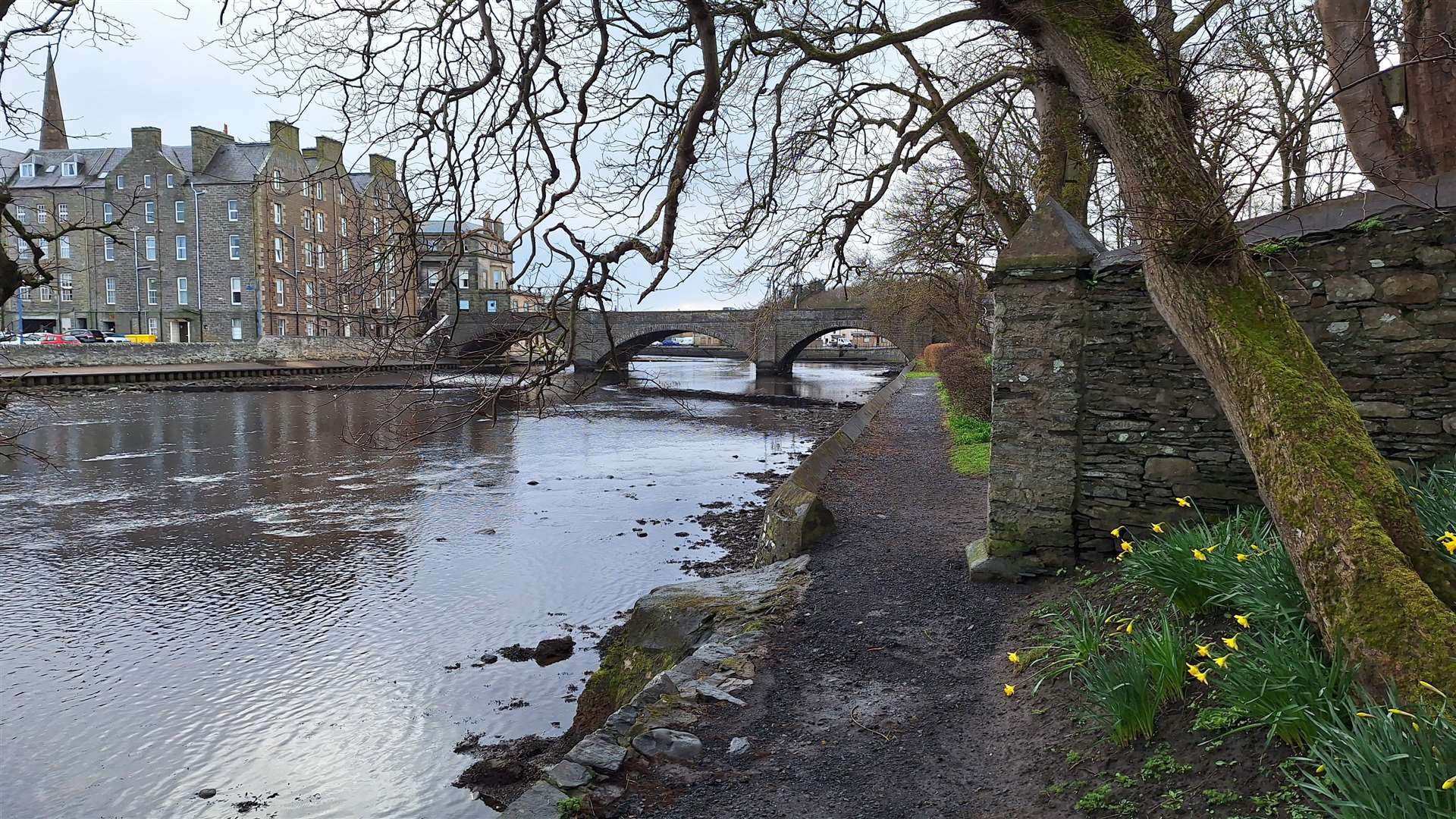
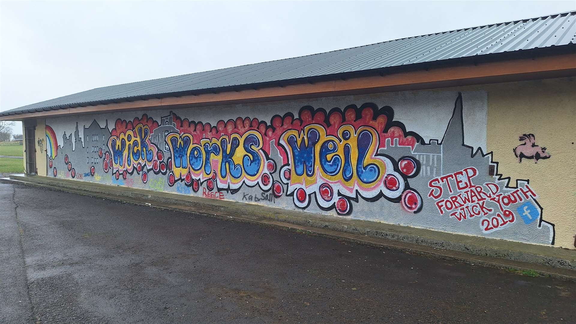
Crossing to the north side of the river on Bridge Street, I followed a small sign pointing down some steps to the left marked “Riverside Path”. The route follows a pavement past the car park and then the boating shed that has been brightened up with graffiti reading Wick Works Weil.
I stayed on the north bank of the river as the path passes the Coghill Bridge, which was built in 1893 as a gift to the town from the merchant Harry Coghill. He was born in Wick in 1823 and left at the age of 15, becoming a dealer of paper bags and twine.
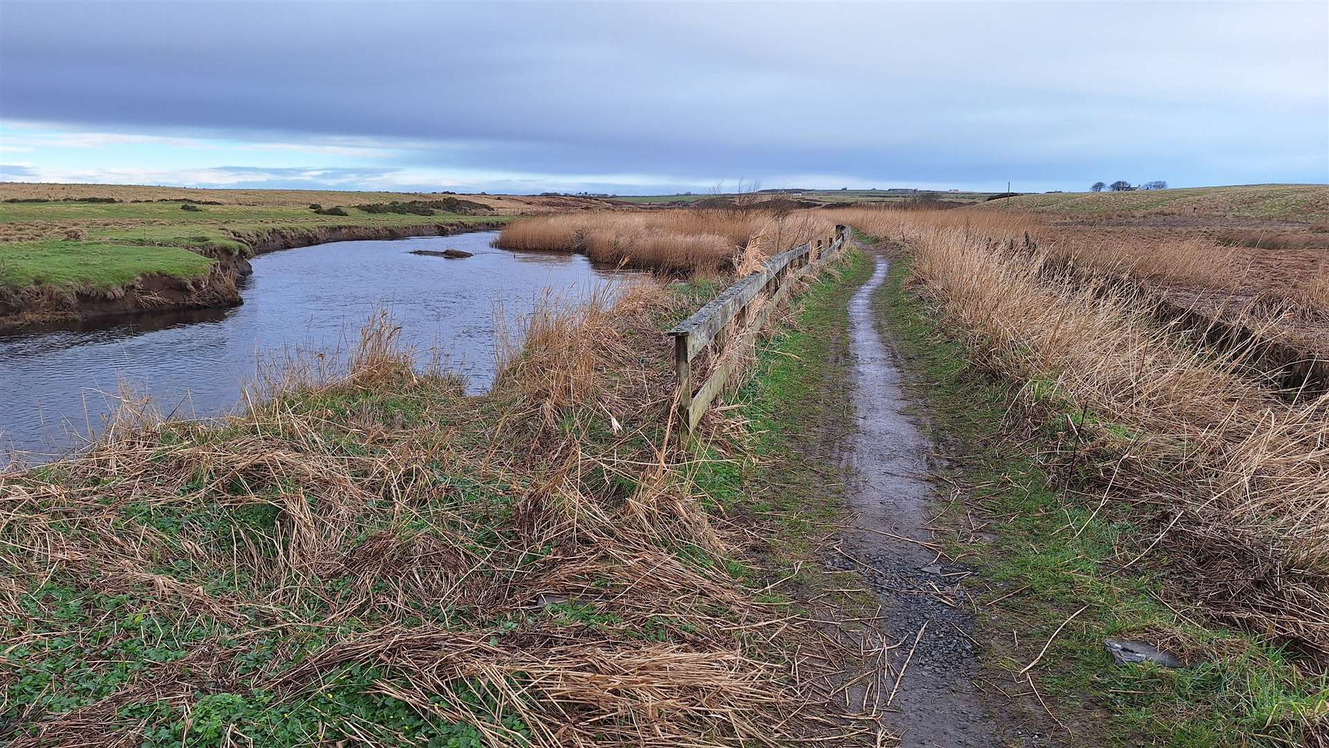
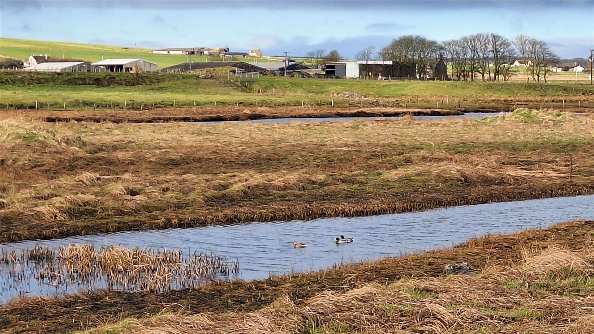
Beyond the bridge, the walk continues to make its way gradually away from the town, along the lower reaches of the river which are bordered by marshes which offer a variety of habitats from birds and other wildlife.
I spotted a cormorant floating along the surface then diving under as it searched for food, while in the patches of birch dotted alongside the path I heard a skylark along with chaffinches, coal tits and more.
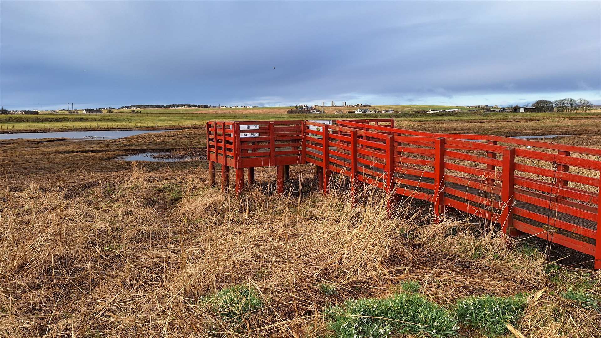
A viewing platform partway along gives a closer view of the waders and wildfowl, with information panels on some of the species you can expect to see here in different seasons, along with some of the specialised plant life that also features here.
After that, the walk is even more peaceful as it makes its way west among open farmland, with only a train trundling by on the far bank disturbing the quiet.
Also on the far side, a small rise known as the Fairy Hillock is the remains of a chambered cairn – an Iron Age burial place, which is recorded as a scheduled monument.
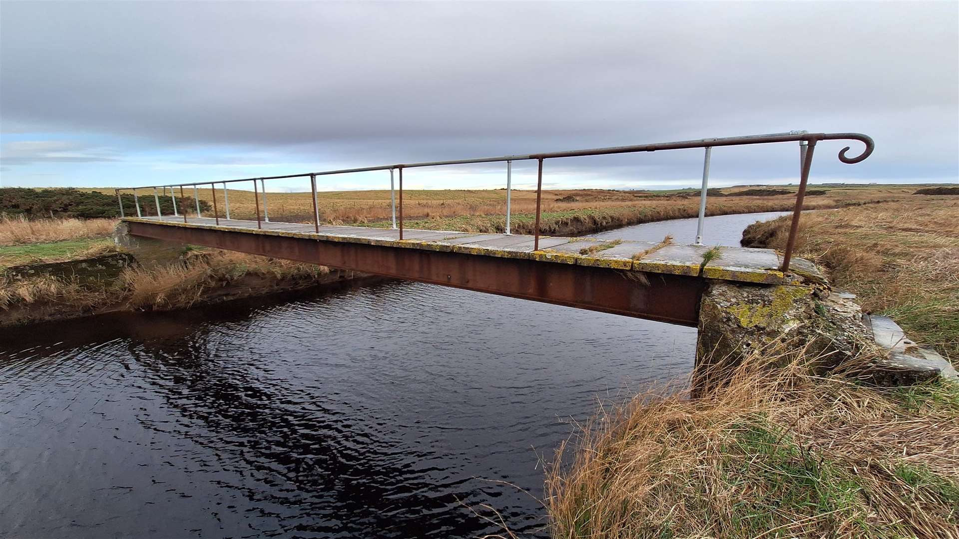
I continued as far as the Iron Brig, a crossing that was apparently funded by the children of West Bank School in the late 1800s who held kinderspiels – or children’s concerts – to raise the money, giving it the title of the Kinderspiel Bridge.
It’s possible to continue further up the river to see the monument to the 1680 clan battle at Altimarlach, but I had to get back to town, so I turned around and made my way back the same way as far as the Coghill Bridge.
Crossing the river here, it’s great to see the recent repairs carried out by the Wick Paths Group which refurbished the crossing and fitted a non-slip surface. The Coghill Bridge reaches a small island, with a path leading over this to a second, smaller crossing that leads to the route on the south side of the river.
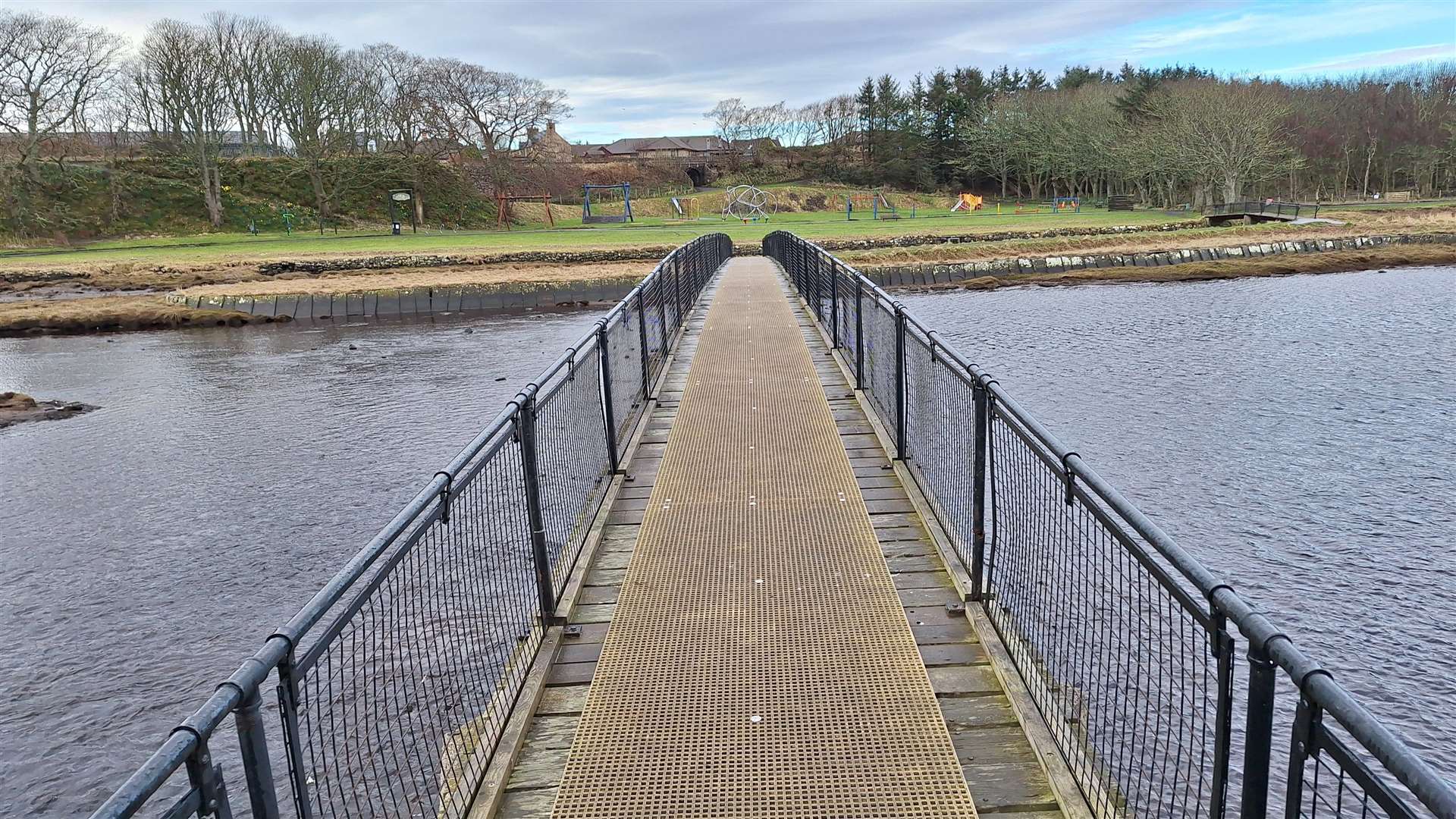
Turning left past the playpark, I headed along the riverside path and the fountain back to the road bridge, emerging at the mini-roundabout opposite Mackay’s Hotel, whose No.1 Bistro is located on the shortest street in the world, Ebenezer Place.
After crossing the road, I followed Union Street – immediately to the right of the hotel and bistro – and continued along Bank Row, the scene of the first daylight bombing raid on mainland Britain in the Second World War in July 1940. A memorial garden here commemorates the 15 people, including eight children, who were tragically killed in the attack, as well as the three people who died in October the same year in a raid on Hill Avenue, near the town’s RAF base.
The Black Steps, just off Bank Row, were made famous in an LS Lowry painting but were built by Thomas Telford who developed the whole harbour area in the early 1800s.
Forking left here I headed down to the harbour where this walk ends – with the option of some refreshments at the popular Wickers World café overlooking the marina.
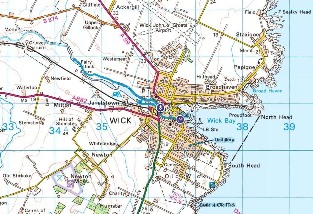
Route details
Wick riverside walk
Distance 3 miles / 5km
Terrain Mostly good paths, boggy in places
Start/finish Wick bridge / harbour
Map OS Landranger 12; OS Explorer 450
Exploring the lower reaches of Wick River
Click here to see the route in OS Maps