

ACTIVE OUTDOORS: Fort of nature in glen below the Ben
Register for free to read more of the latest local news. It's easy and will only take a moment.

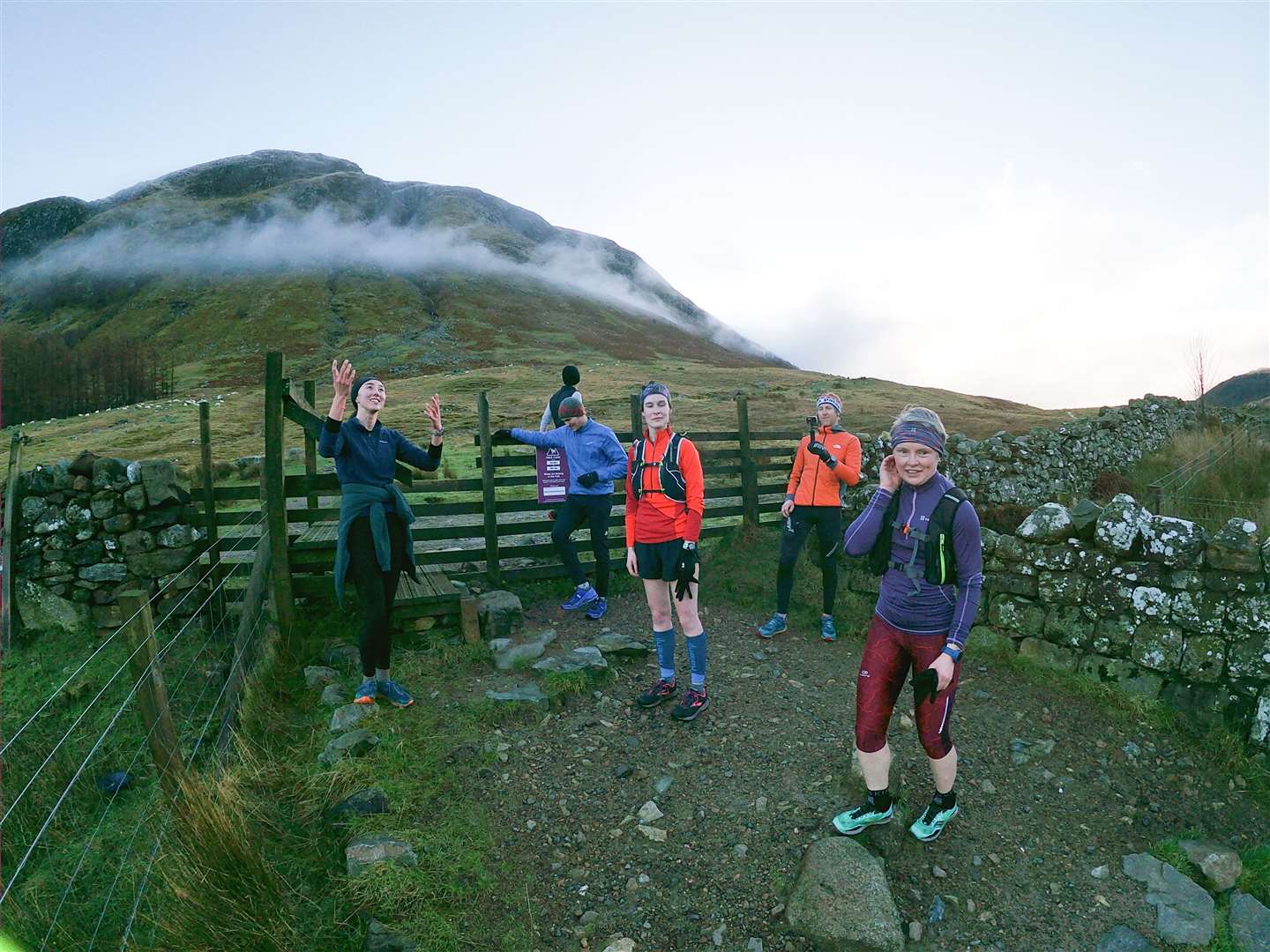
The glen was crisp and quiet, the peace of the early morning enticing us on. A late winter drop of snow on the mountains added to the scene – although our relatively short outing this morning would be a low-level easy run on a mix of road and trail.
As part of the Fort William Mountain Festival, this “Rise and Run” fringe event invited people to join a local expert from the Runners Need store in the town’s High Street for a sociable guided route.
George Fisher had been one of the speakers at the Tales from the Trails event at the festival the previous night, and is a great advocate for skyrunning, but he was equally content to be sharing some of his easier local trails with like-minded runners today.
There was a distinct chill in the air as I made my way along a quiet High Street to the store, where I was welcomed inside as we waited for everybody to arrive. Before we took a step outside, I was asked for my breakfast order – a bacon roll and steaming hot cup of tea would be waiting for me on our return. The weekend couldn’t start much better than this!
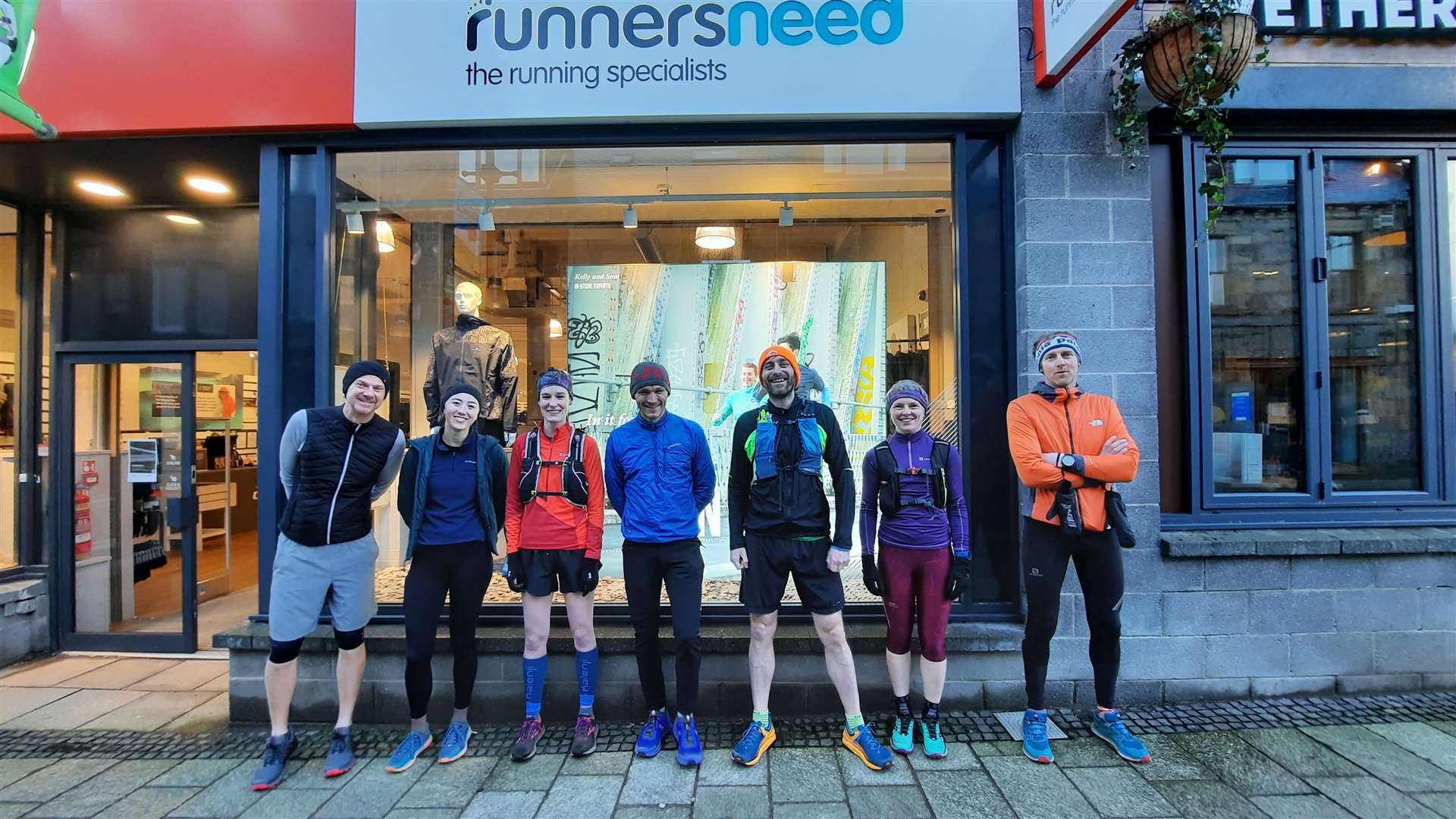
After a quick introduction and photograph outside, we headed down the High Street and past the Belford Hospital, jogging gently along the pavement beside the main road to pass the leisure centre and reach a roundabout.
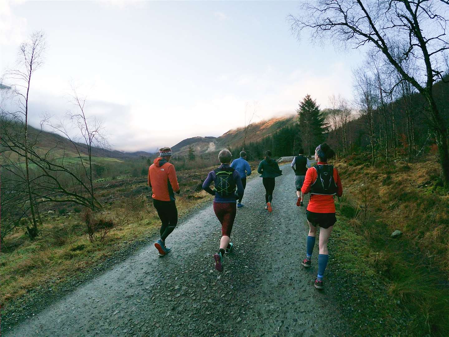
We would head straight on here, following the Glen Nevis road past a few houses before leaving the built-up area behind. The road follows the line of the River Nevis, which is fed further upstream by water off the steep slopes of the Ben itself as well as from the mighty Mamores.
At a track we forked right through the “Braveheart car park” – one for the tourists there, but a great starting point to explore Glen Nevis [https://forestryandland.gov.scot/visit/glen-nevis] with plenty of options for heading further into the heart of this spectacular spot.
Route details
Glen Nevis from Fort William
Distance 5.25 miles / 8.5km
Terrain Pavements, forest track, paths, minor road
Start/finish Fort William High Street
Map OS Landranger 41; OS Explorer 392
A gentle run from Fort William onto some tantalising trails below Ben Nevis
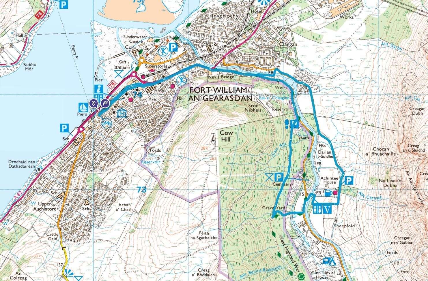
Click here to see the route in OS Maps
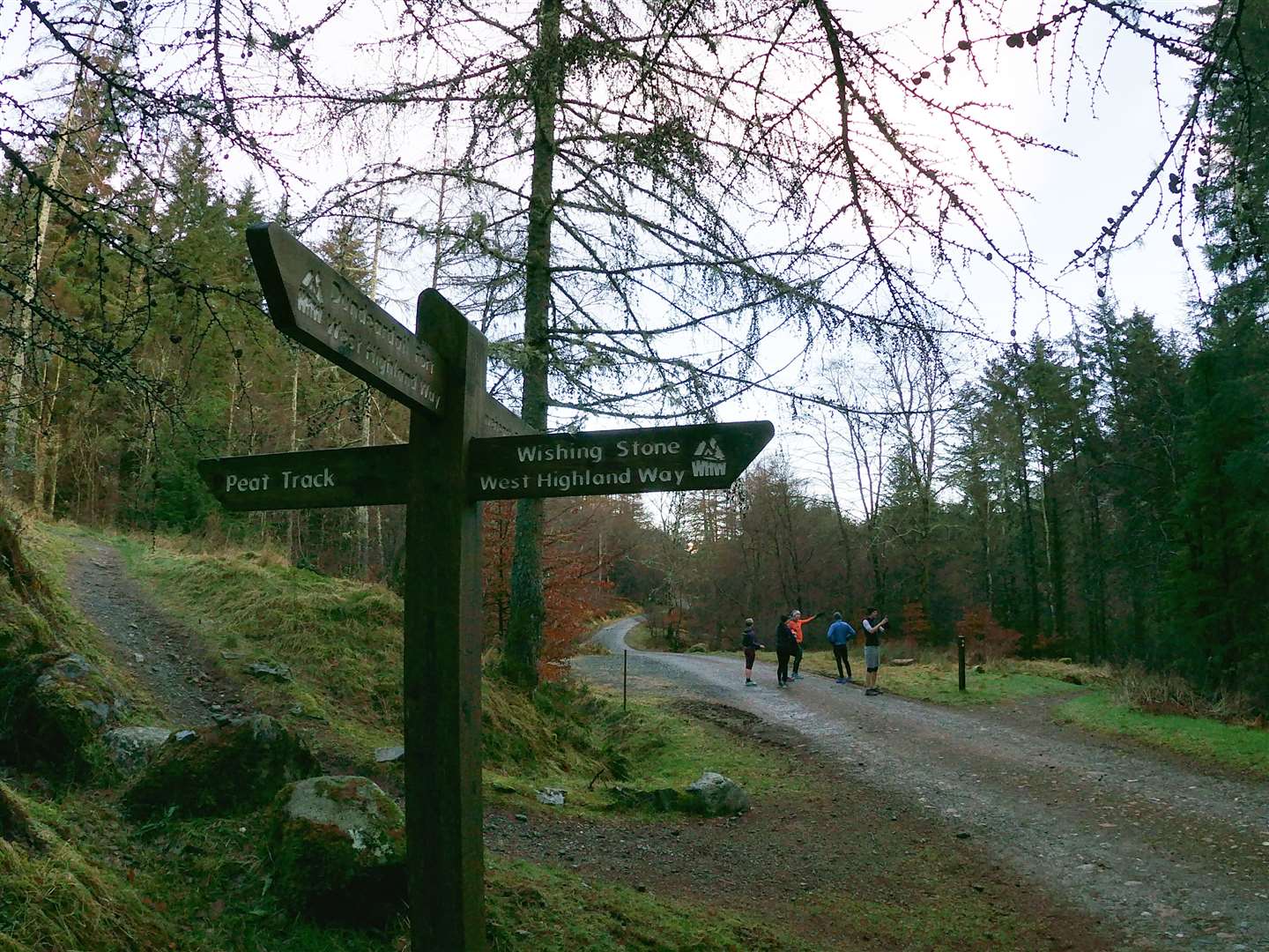
Cow Hill offers a great vantage point and is easily accessible, while another route follows tracks and a rougher path to the Iron Age fort at Dun Deardail, with both routes having fine views to Ben Nevis when the weather is on your side.
We followed the main forestry track ahead which climbs almost imperceptibly. In the distance, the westernmost snow-capped Mamores were now lit in the morning sunshine, as the early-morning cloud began to break up and lift off all but the highest summits. Ben Nevis was still hidden in the cloud high above, as it so often is.
At a crossroad of paths and tracks, we turned left to enjoy a lovely little downhill on a narrow trail through the trees. As it levelled out alongside a field, I remembered why it felt familiar – seven or eight years ago I had run the Glencoe Marathon and this was the last stretch after a testing 26.2 miles running from Glencoe village, over the Devil’s Staircase to Kinlochleven then through the Lairig Mór and into Glen Nevis.
I would be tempted to return and take part in the event again, but unfortunately this year’s Glencoe Marathon has recently been cancelled.
At the road, we turned left then crossed over to follow a path behind the Ben Nevis Visitor Centre, leading to a footbridge over the River Nevis. Our route initially followed the way up the Ben, going right then left up a path to a stile.
A few hill walkers were making their first steps of the long and arduous climb of Britain’s highest mountain, but we veered away, turning left to pass the Ben Nevis Inn which sits at the end of a single-track road that we now followed down towards Claggan on the edge of the Fort.
On the way, one house in particular had a series of nature-friendly signs painted outside, which was great to see.
Seeing another footbridge ahead, we headed left to cross back over the river, turning right past the curling ponds and the split stane to rejoin the glen road back into Fort William.
By now the High Street was, if not bustling, at least a little busier. The town centre has a bad reputation in some quarters, but as well as some fine pubs, cafés and restaurants, there are also a few great independent stores to explore here – not least the excellent Off Beat Bikes across the road from the Cotswold Outdoors/Runners Need shop.
On our return, we were welcomed with the promised bacon roll and cup of tea – a fine end to a lovely run in good company. The only danger was finishing in a shop with all this shiny new outdoor gear…


