

ACTIVE OUTDOORS: Blown away by high route above the Slochd
Register for free to read more of the latest local news. It's easy and will only take a moment.

Perhaps choosing the high tracks over the northern tip of the Monadhliath mountain range wasn’t the wisest of decisions, given the forecast for strong blustery winds.
Nevertheless, I needed to blow the metaphorical cobwebs away, so what better way to do it than climbing to not short of 600 metres above sea level and accepting whatever the weather threw my way.
It wasn’t cold, thankfully, as I set off from the Strathdearn community hub in Tomatin – which has a lovely café that makes a great place for some après-ride refreshments. I headed south on the road through the village and over the Findhorn Bridge, my first target being the Slochd pass.
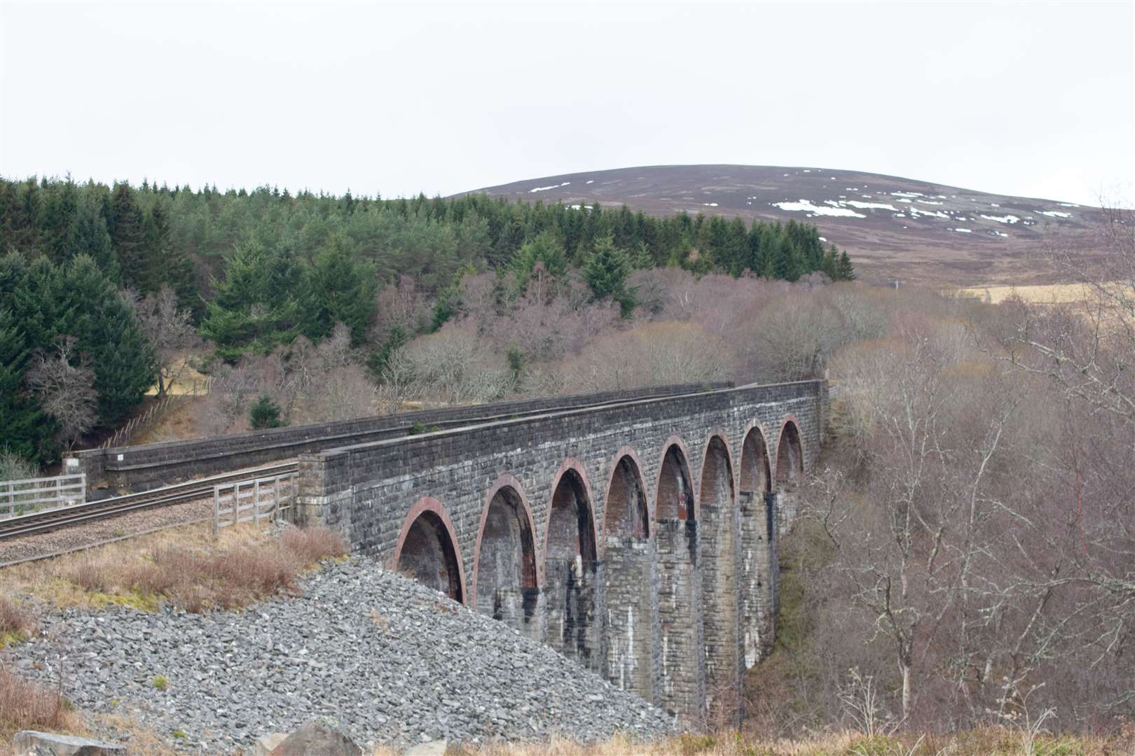
I always enjoy cycling through this narrow passage on the official cycle route, which squeezes between the edge of the A9 road and the railway line, which is blasted through the rock here.
There’s a long history of routes passing through here, which is not that surprising given the lack of other options to cut through the hills. As you start to descend on the far side, the cycle route follows the “old A9” – the 1930s version – and a track forking up to the right is the old military road that General Wade had built in the late 18th century.
I’d considered that option for this ride, as it makes a fine route and is easily rideable, but I kept straight on to meet the road at a gate, turning right and following the back road past Slochd Cottages.
The road ahead is closed to motor vehicles due to a weak bridge over the railway, which makes this road even more enjoyable for cycling due to a further reduction in traffic.
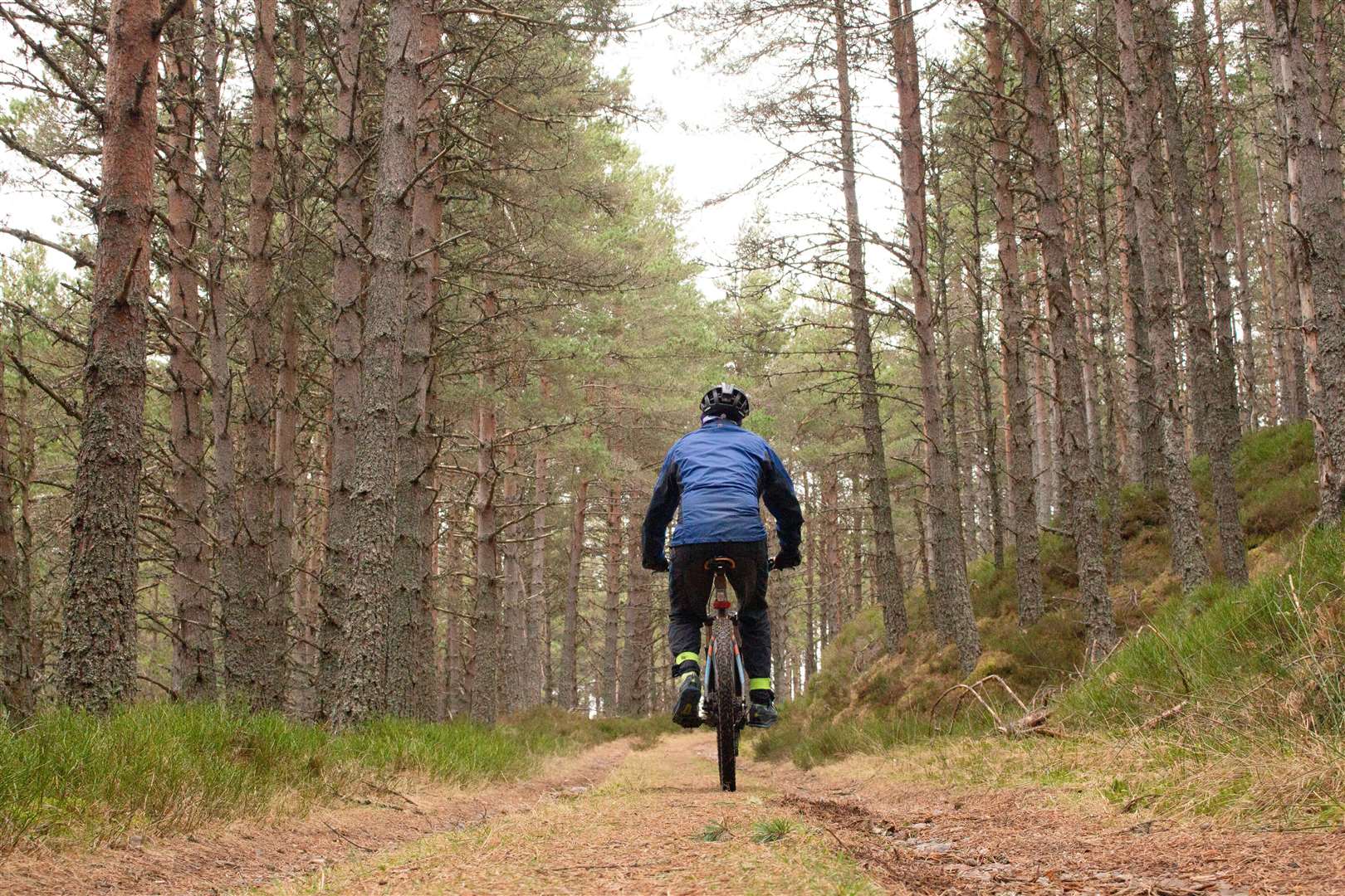
At the old hostel, I headed right to leave the road and cross over the railway by a track leading into the forest. Immediately after the bridge, our route goes left to climb up a nice forestry track, keeping left where it is met by another track higher up.
Ignore a couple of tracks off to the right close together, and keep ahead as the track runs parallel to the modern A9 to the left. Where you see a large metal gate at the bottom, take a sharp right before reaching the gate.
Route details
Tomatin to Sluggan Bridge loop
Distance 15 miles / 25km
Terrain Surfaced cycle path and road; forest and estate tracks, rough in places
Start/finish The Strathdearn, Tomatin
Map OS Landranger 35; The Strathdearn Access Map
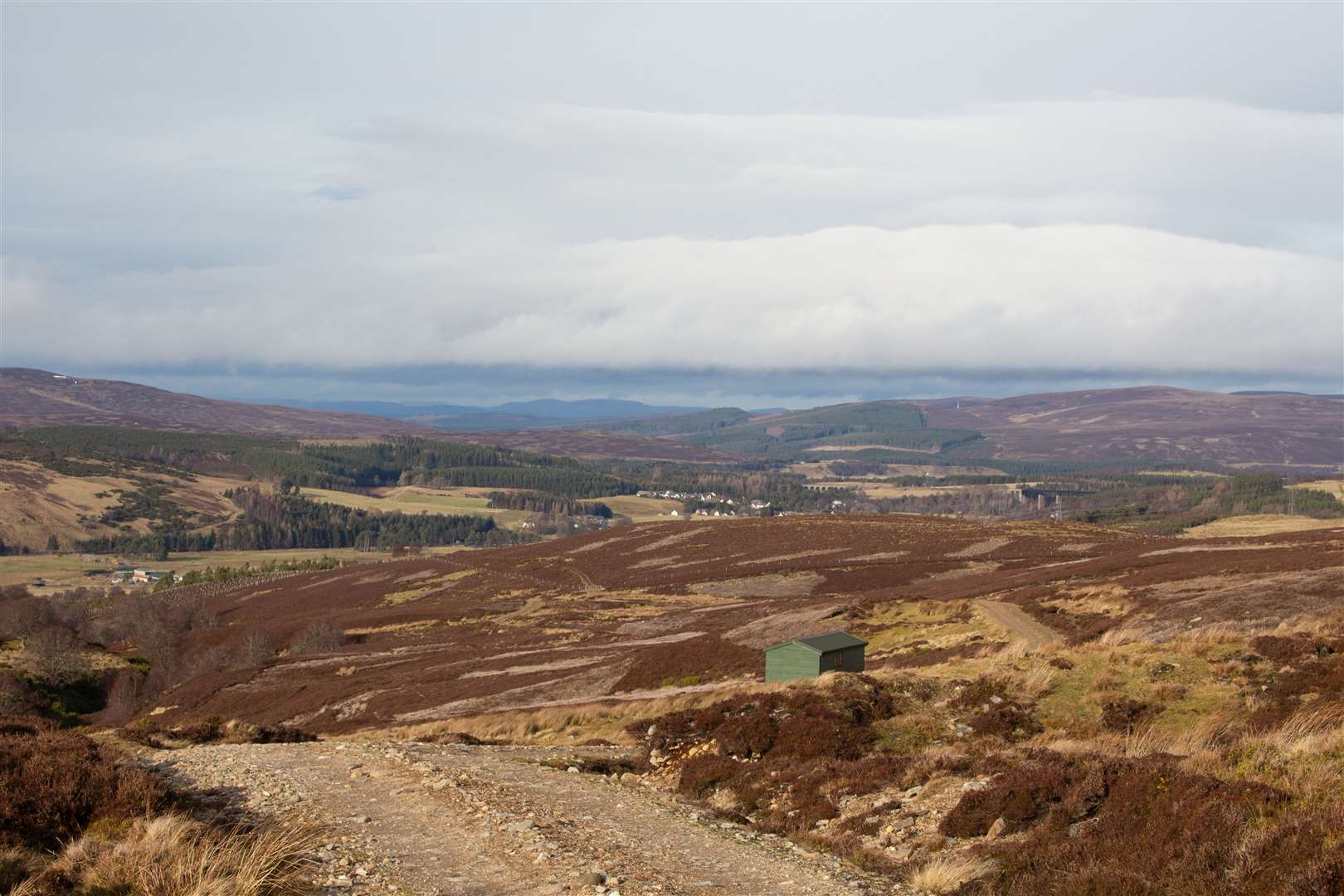
The Slochd has offered a passage to travellers for centuries, and this route gets even higher
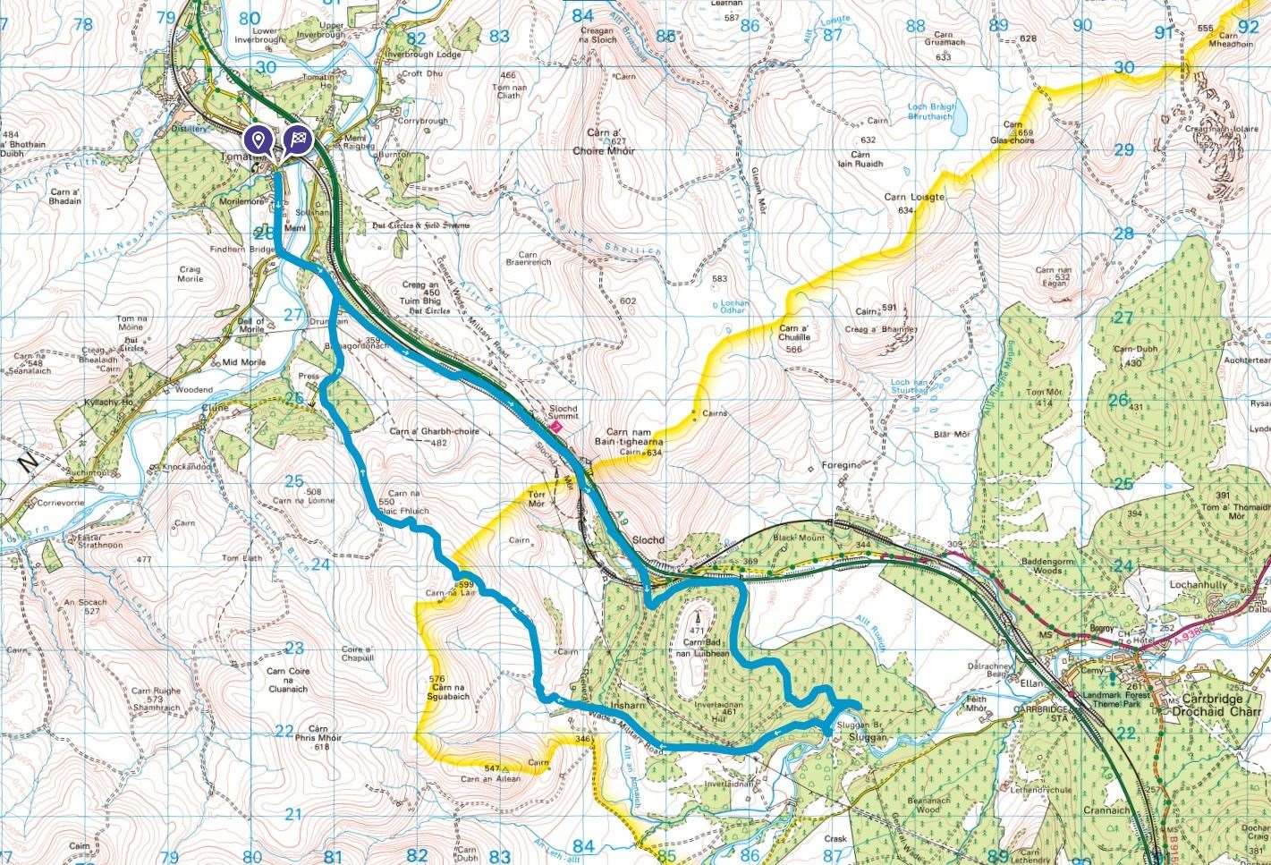
Click here to see the route in OS Maps
This leads you round the back of Carn Bad nan Luibhean, still on good tracks that make for easy cycling. On the descent, take a left turn and follow the track to a gate, where a notice explains that there will be forestry works here later in the year – although there has clearly been quite a bit of work recently, too.
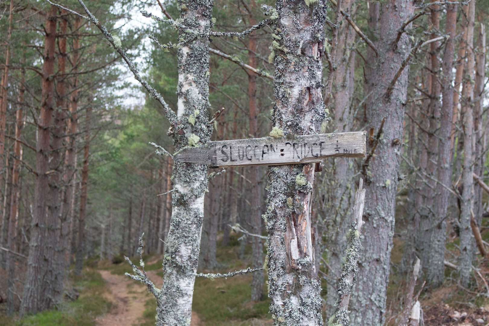
I kept right after the gate to pass between some stacks of logs, then was mindful that I would need to take a right turn off this main track soon. It might not be an obvious one if you don’t know these trails, but you should see the back of a small wooden sign nailed to a tree. Looking at the front of it, it points down an older, grassy track to Sluggan Bridge, half a mile away.
This is a fantastic descent through the trees, though it ends in a muddy area before a high gate, so you need to lift your bike onto the higher ground to the right to use the smaller, unlocked gate.
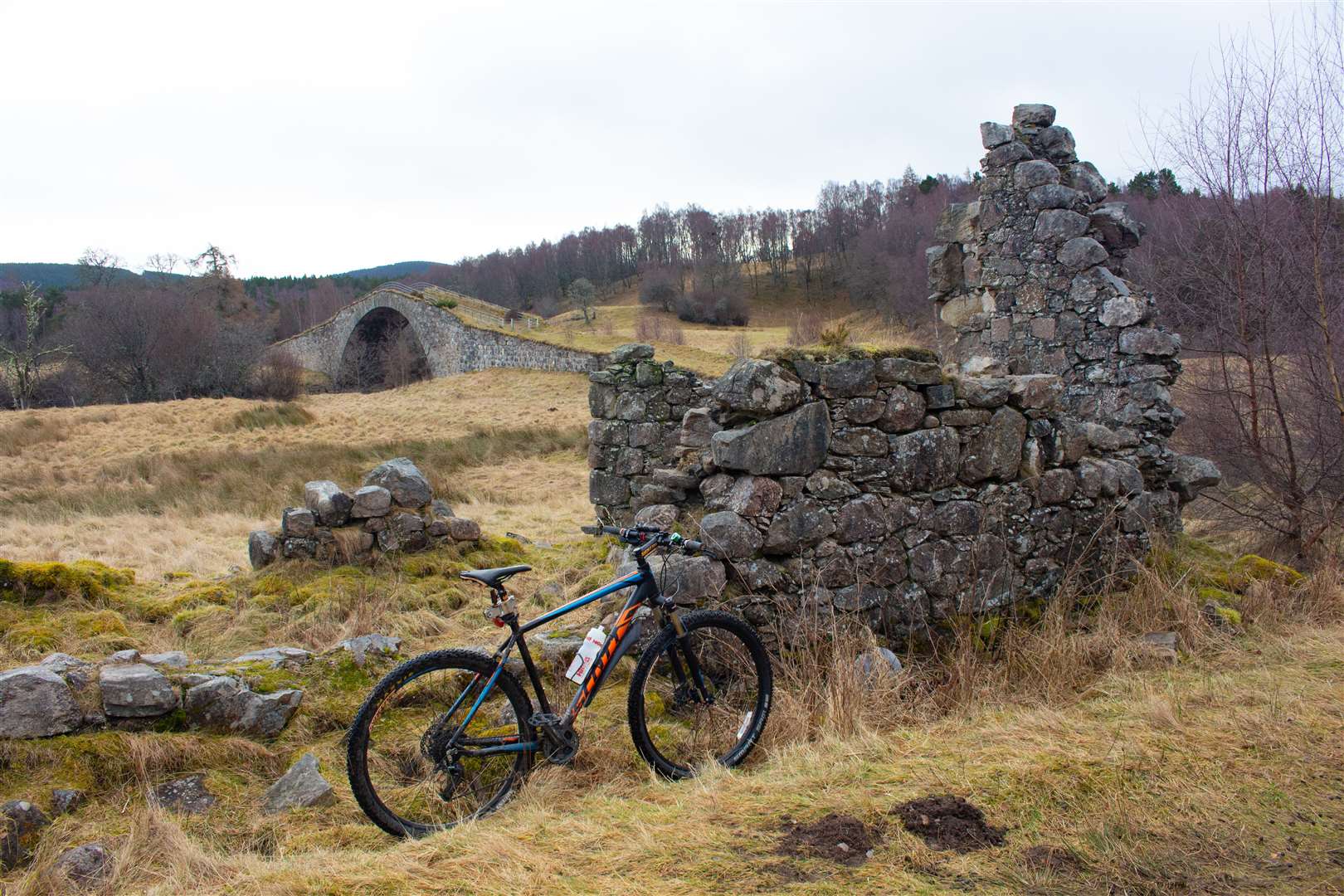
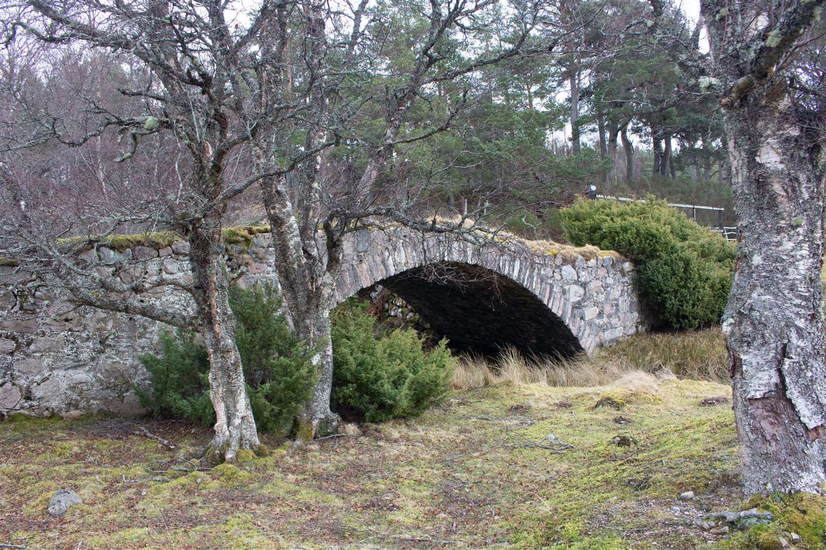
As you emerge from the trees, you can see the Sluggan Bridge a short way ahead. The bridge was built by Wade’s successor, William Caulfield, and there seems to be some uncertainty as to whether it survived the floods of 1829 or if it was rebuilt thereafter. Either way, it is a striking monument and a fine piece of engineering, and is well worth a cycle to visit in itself.
Today, it marked my turning point. Instead of crossing the bridge, I turned right at the ruin and climbed the hill, following more ups and downs – some very steep – along the route to Insharn. After passing through a croft, go straight ahead through the gate (which was wide open on my visit) rather than following the track round to the right.
The small bridge over the burn here is an old Wade bridge – perhaps not quite as eye-catching as Sluggan but one of many functional bridges the general had built that were revolutionary in their day.
The military road actually heads right into the dense forest here, but my return route to Tomatin was over the hills, so I went past this junction then kept a direct line straight ahead where the clearer track bends left.
Cutting through the corner of a nice section of forest as it climbs onto the moors, the going was steep but not too energy-sapping for now. Emerging onto the open hillside, the wind certainly picked up, and as I climbed higher it became, not surprisingly, stronger and stronger.
The route back follows the main track over the hills, keeping straight on where a couple of tracks head off to the left. Higher up still, the track bends left to aim for a shoulder of Carn na Lair. Here the wind was blowing me into the peat at the side of the track, and it was an effort to keep the front wheel in a straight line for any length of time as the air howled through my spokes and buffeted against me.
Near the top, I got off and walked for a while, only to find a long stretch of the track blocked by lingering snow. I cautiously made my way along the edge of the patch then over the top when I was confident my soft trainers could get enough grip.
The track leads towards a mast and I kept walking up to a gate, after which there is a T-junction. Thank goodness! Some downhill at last. Although that didn’t help much. A fierce crosswind made it impossible to pick up any speed without risking being blown, quite literally, off track!
Further on, heading downhill straight into the wind, if I stopped pedalling my progress was halted and I came to a standstill. There are not too many occasions I’ve had to contend with pedalling harder going downhill than uphill, but this was one of them.
At a track junction, I headed right to continue my descent, now with a lovely, sunlit view over the Findhorn valley with the three bridges of Tomatin visible. Further on, at a fenced area where the main track turns sharply right, go straight ahead through the gate to continue through a heather-clad area.
There were sheep lower down and some messy mud to negotiate as I made my way out to the road at Press, going right on a newly resurfaced stretch of tarmac to meet my outward route a short way above the Findhorn Bridge.