

Six winter walks across the Highlands and Moray
Register for free to read more of the latest local news. It's easy and will only take a moment.

A winter walk is a great way to embrace the fresh air and benefit from the great outdoors. John Davidson suggests six strolls in the north of Scotland
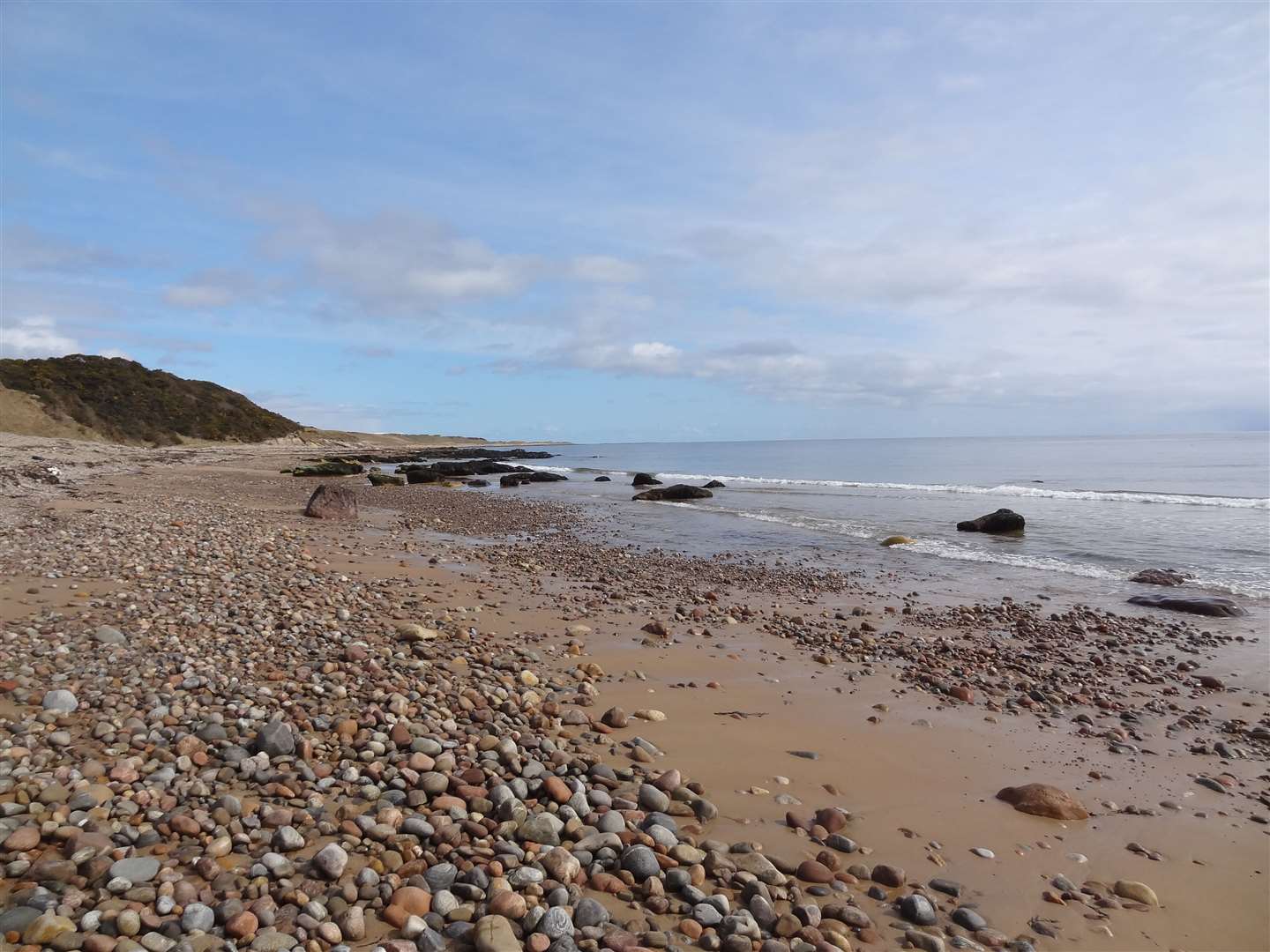
Brora-Golspie shore path
A bracing walk along the coast is in store on this stretch of the John O’Groats Trail, which connects the villages of Golspie and Brora.
Starting at Golspie, a path leads off Duke Street at the north end of the village, where the main road bends left. It crosses a footbridge and suddenly you are on the grassy shoreline.
The path goes for almost seven miles, skirting the beach at high tide and sometimes following it on sand and stones if the tide is out.
Straight away, you pass the impressive Dunrobin Castle, with its towering conical spires making it look like something out of a fairytale as it dominates the view.
A little further north is an even older structure – a magnificently preserved Iron Age broch that’s worth the very short detour to investigate. Carn Liath Broch is built on a raised beach and you can wander around its edges and into the interior.
Further on, about a mile from Brora, there’s a little burn to cross on the beach. The pretty little waterfall emanates from the Sputie Burn, trickling into the Moray Firth through golden sand.
After the sand, it’s easier to follow a grassy path above a sea wall to reach a car park and picnic area at Brora.
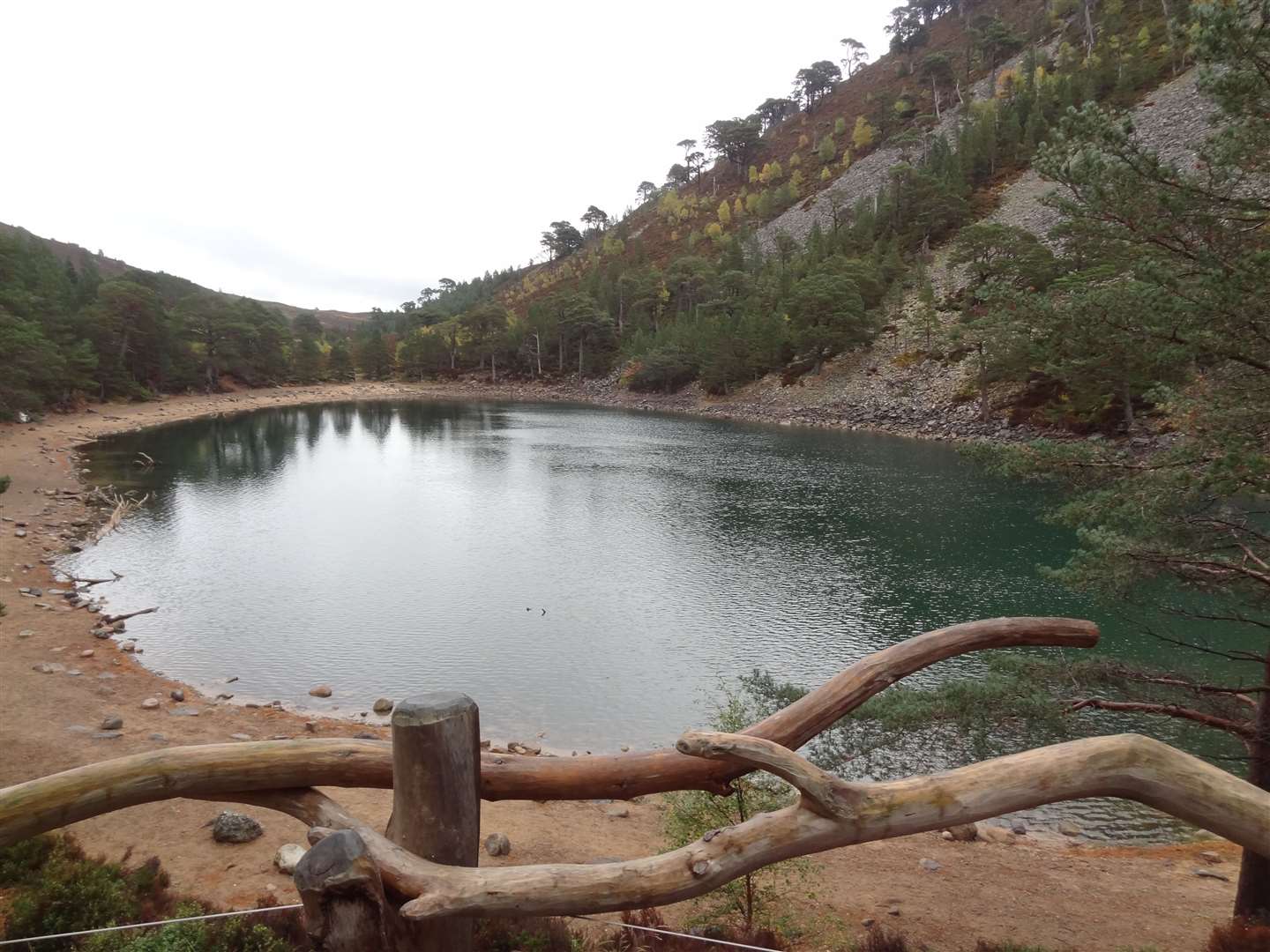
An Lochan Uaine
The green lochan is the heart of the Cairngorms National Park is an achievable target even in the depths of winter. I’ve even been known to ski – very badly – on these trails when there’s been enough snow!
A well-made path follows a line from Glenmore Lodge towards the Ryvoan pass, reaching the lochan after a couple of miles.
However, there’s a nice circular route that can be completed with a more interesting approach, which allows you to use that direct path for the return journey.
Start at the Glenmore Visitor Centre and head up the track behind the reindeer centre. Take the first forestry track to the right – following the marked blue trail – and climb high above the glen, with great views over the mountains once you’re out of the trees.
Further on, a narrow, twisting trail descends through woodland, over rocks and tree roots, to reach a junction opposite An Lochain Uaine.
There are a number of suggestions as to where the lochan’s name comes from – the most interesting being that the water is green because fairies wash their clothes in it. However, a more pragmatic version is due to algae and the reflection of the surrounding trees.
Either way, it is a delightful place to walk, and this circuit is completed by turning right and following the path back past Glenmore Lodge to the reindeer centre. You may even be lucky enough to see one of Santa’s reindeer in the paddock on the way past!
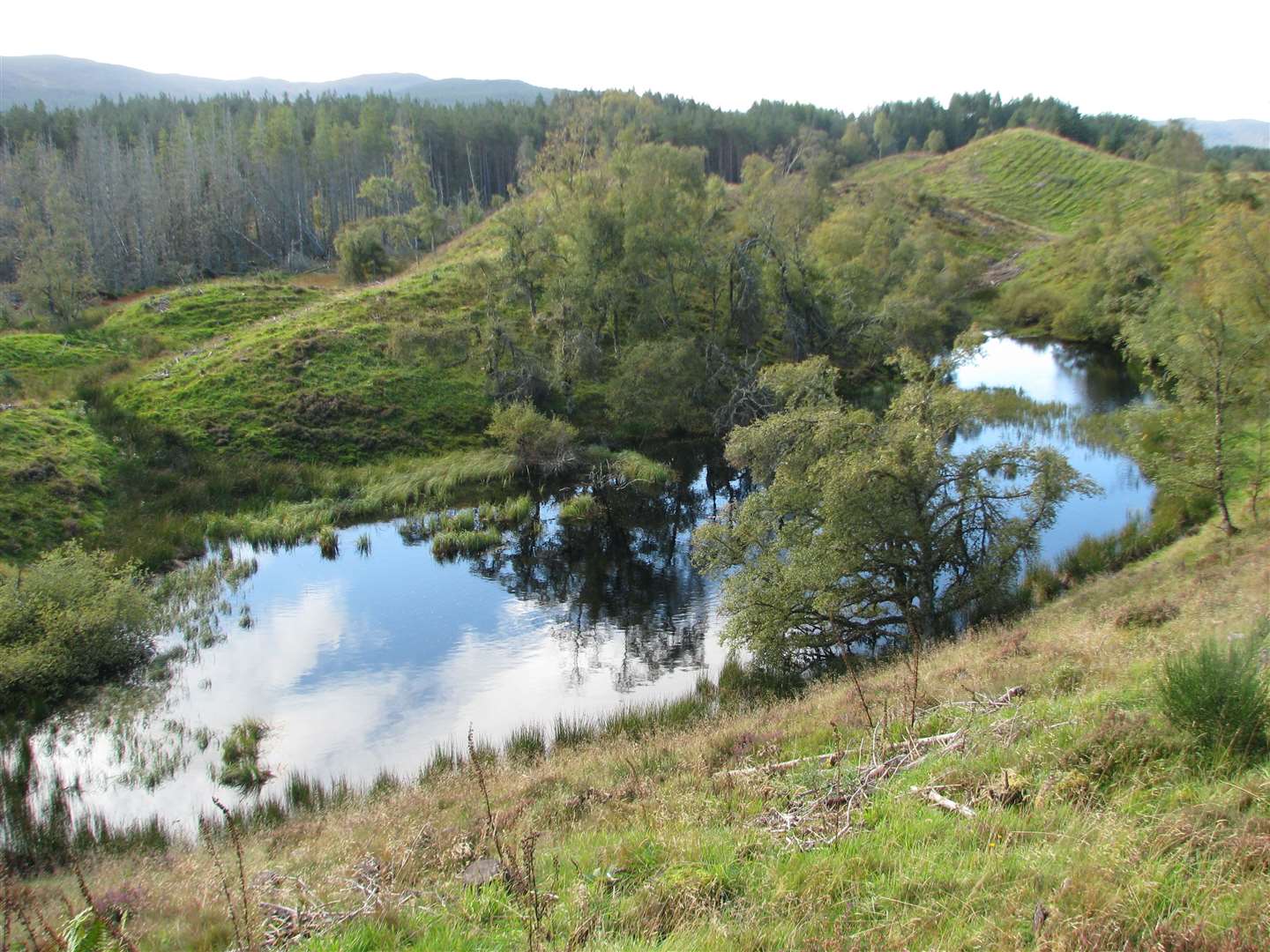
Littlemill
Geological wonders lie in wait at this small site in the hills above Inverness. Follow the Esker Trail to discover the remains of a glacial landscape, with kettle-hole lochans and esker ridges, marking areas at the edge of an ancient glacier.
A couple of waymarked loops offer short walks from the forestry car park, but I prefer to link them together to make a longer circuit – even then, it only amounts to less than three miles all in.
A steep path heads up from the car park, which can be found between the A9 and Inverarnie on the back road to Fort Augustus.
At the top, take a left to follow the ridge round to the boundary of a quarry, where the path turns right to drop steeply downhill. Keep the most obvious path as it bends back round to the right, through a muddy area, then you arrive at a marked junction.
Turn right to head directly back, or left to continue on the longer circuit.
Just a few miles from the Highland capital, this is a popular spot but it’s also a peaceful place to come and enjoy just wandering and listening to the birds. The children also enjoy the adventure of the narrow and muddy paths that stop them getting bored!
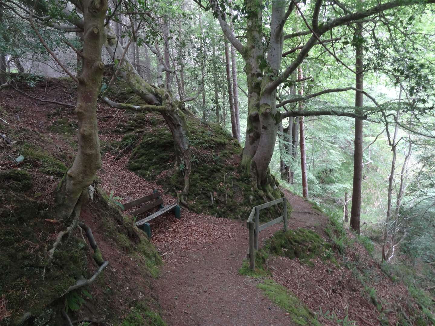
Winding Walks
This large forestry site outside Fochabers offers no end of options for woodland walks – and even a spot of mountain biking thrown in.
There’s a steep-sided gully carved out by the Small Burn. The original Winding Walks – a series of paths criss-crossing the burn, were laid out in the 19th century by the Duke and Duchess of Gordon. This woodland was once part of their estate, connecting to Gordon Castle.
Escape on the Peeps View Trail to a gazebo tucked among pines at the viewpoint. Forestry and Land Scotland says the gazebo is inaccessible at the moment due to structural issues, but you can still enjoy the view out over Fochabers and Strathspey.
You can also follow the Small Burn Loop or Secret Loch Way to explore further into the forest. The secret loch – Longhowe Loch - was once a curling pond and is now a great spot for a picnic.
For a longer circuit, take to the blue trail to discover a monument in memory of the Duchess of Richmond. It lies at the top of Whiteash Hill, from where there are also fine views across the Moray Firth. A little way down the hill on this route, Ranald’s Grave marks the spot where a local man once lived and died.
The circuit joins the Small Burn Loop to return to the main car park.
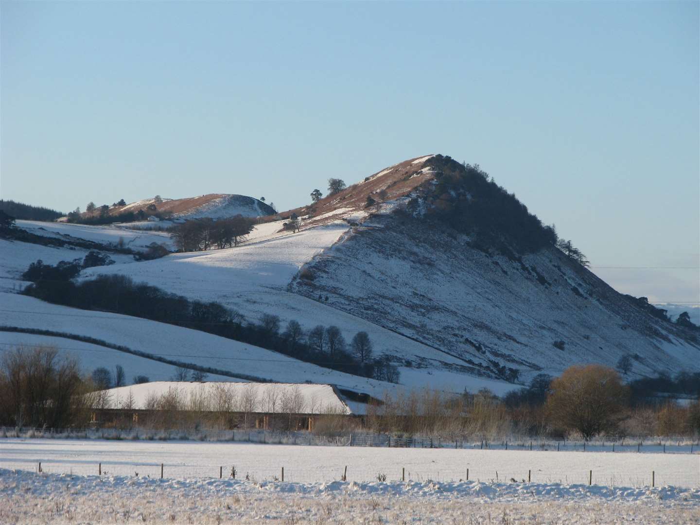
The Cat’s Back
Rising above the Ross-shire county town of Dingwall, Knockfarrel gets its colloquial name from the shape of its ridge, which resembles a restful cat.
There are a number of ways to climb this lovely little hill. One of my favourites is to start in nearby Strathpeffer and follow the old railway line which once connected the spa village to Dingwall.
There are plans to continue the upgrading of the path along the old line to once again link the two villages and allow people to easily walk and cycle between the two – but sadly they have been temporarily stalled by one or two objections.
The route turns right through a gate into a field (just after a small sewage works) and climbs diagonally through a couple of fields to reach a path in between two fences. This leads higher to a track, where a sign points left to Knockfarrel.
You pass a small parking area (but don’t tell anyone you can drive this far – it's much better on foot!) before climbing up a grassy slope to the remains of an Iron Age fort. There are panoramic views from here, and on a clear winter’s day they are spectacular.
To return, you can follow forest tracks through Blackmuir Wood or head along the ridge to Cnoc Mor, before descending to the village.
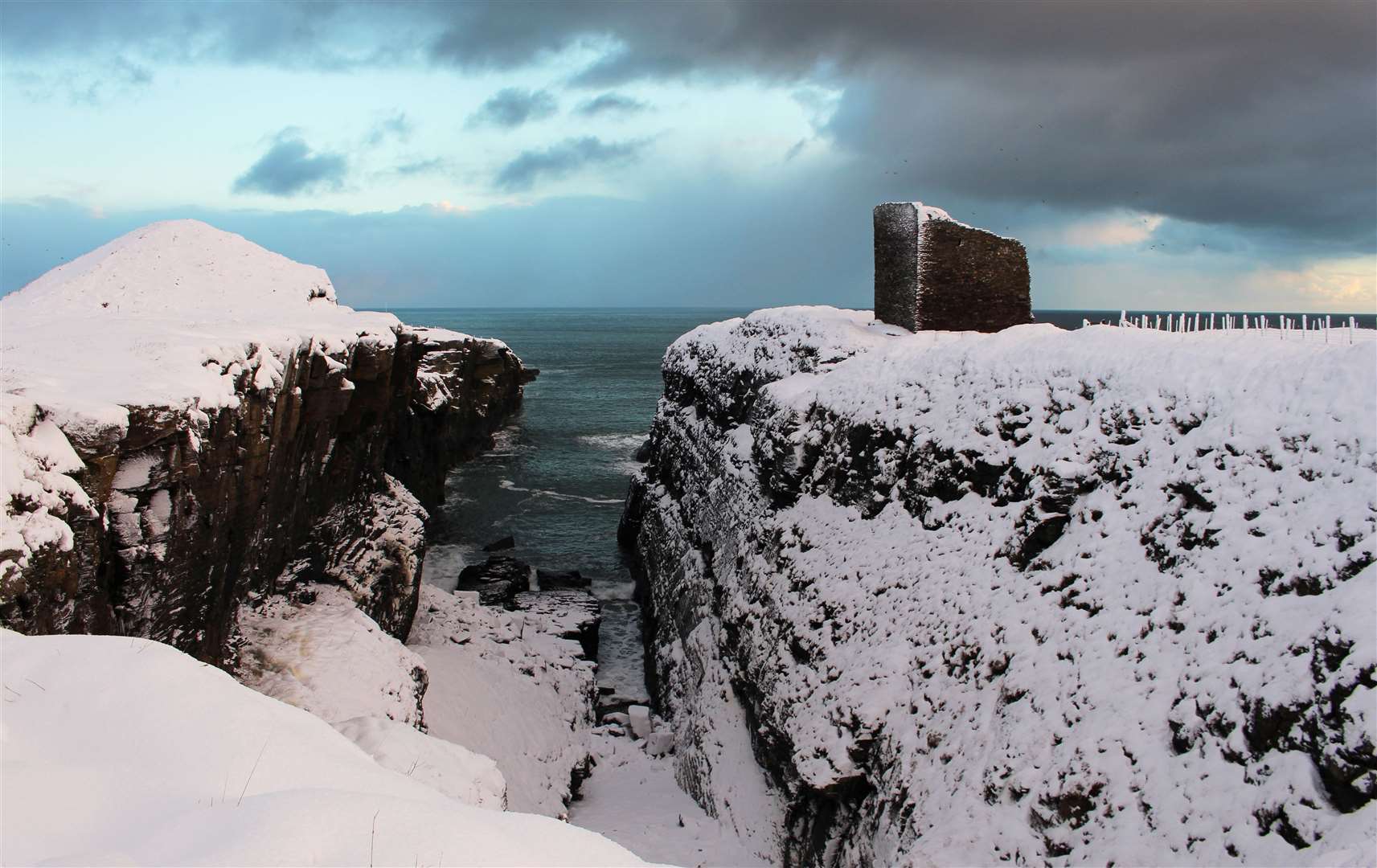
Wick river and coast
Without venturing very far from Wick, this walk around its western and southern outskirts offers an interesting mix of scenery from gently rolling farmland to rugged cliffs, writes Alan Hendry.
Starting at the riverside, where there is a free car park, you cross the restored Coghill footbridge looking out for some of the abundant bird life. Follow the path past the caravan site and go under a railway bridge before emerging in Riverside Drive where it joins the A882.
Head out of town as far as Milton, taking care when crossing before going up the slope towards Newton on a minor road. At Newton Hill there's a panoramic view of the royal burgh.
You could head down from here past the community campus but it's best to keep going to Newton Row, where a footpath takes you along the Charity Farm track to the A99 junction. Again take care when crossing.
You soon come to March Road on the right. Go up it to join the footpath leading (via an old rifle range) to the 850-year-old Castle of Old Wick, perched on a cliff-top.
From the castle path a gate leads into a field (muddy at this time of year) before emerging at the Trinkie road. This winds its way into Wick and you can stroll round the historic harbour before making your way back to the riverside.