

Met Office warning of snow and gales – Storm Arwen may bring gusts of over 75mph to Sutherland
Register for free to read more of the latest local news. It's easy and will only take a moment.

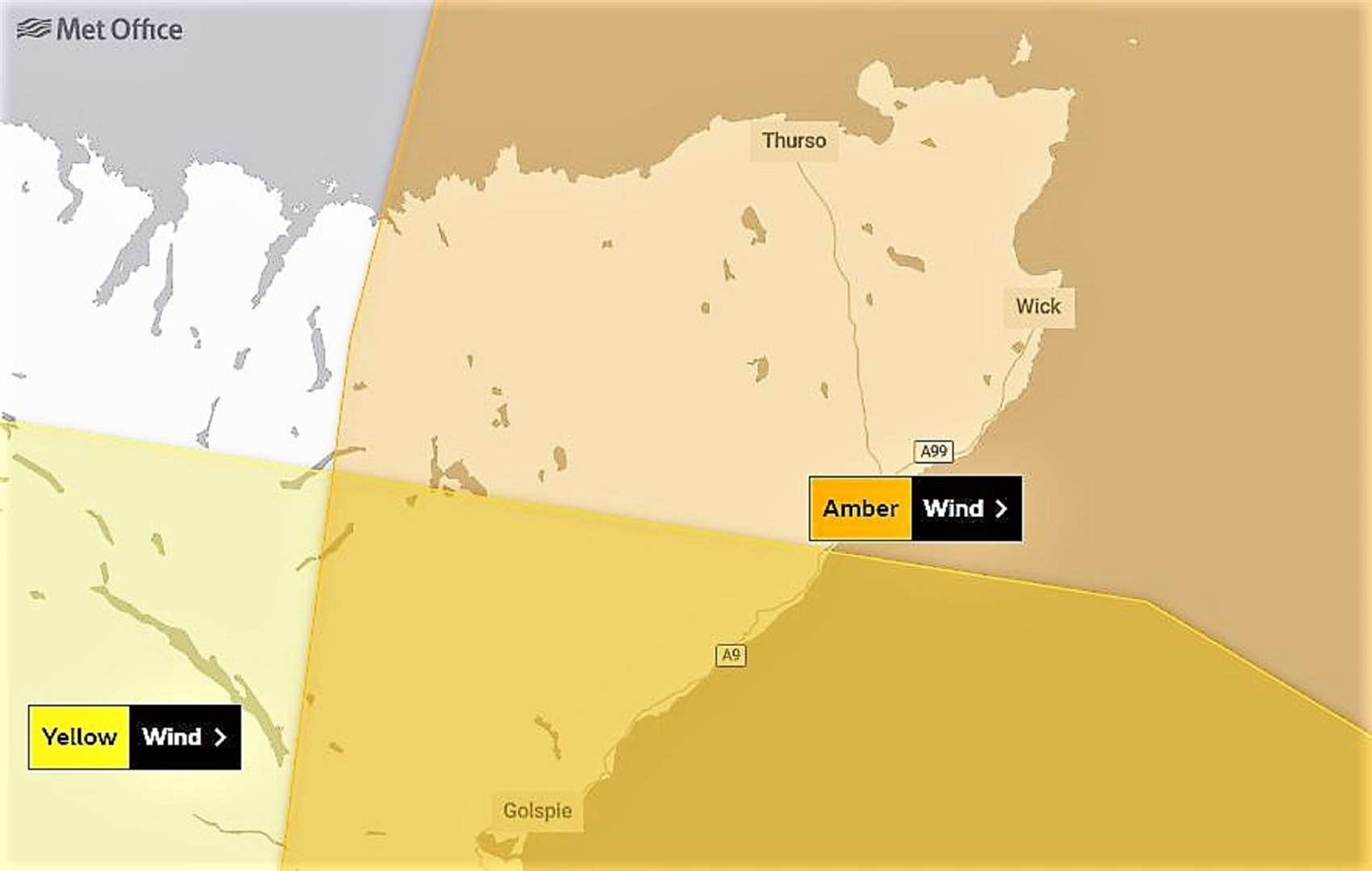
The Met Office warns of wintry showers affecting Sutherland and an Amber Warning is in place for high winds forecast on the back of Storm Arwen tomorrow.
A bulletin issued today states: "Storm Arwen will bring high northerly winds southwards across Scotland during Friday afternoon and evening, the highest winds then becoming confined to northeast England early Saturday. Gusts of 65 to 75 mph are expected in coastal areas with gusts in excess of 75 mph in a few places."
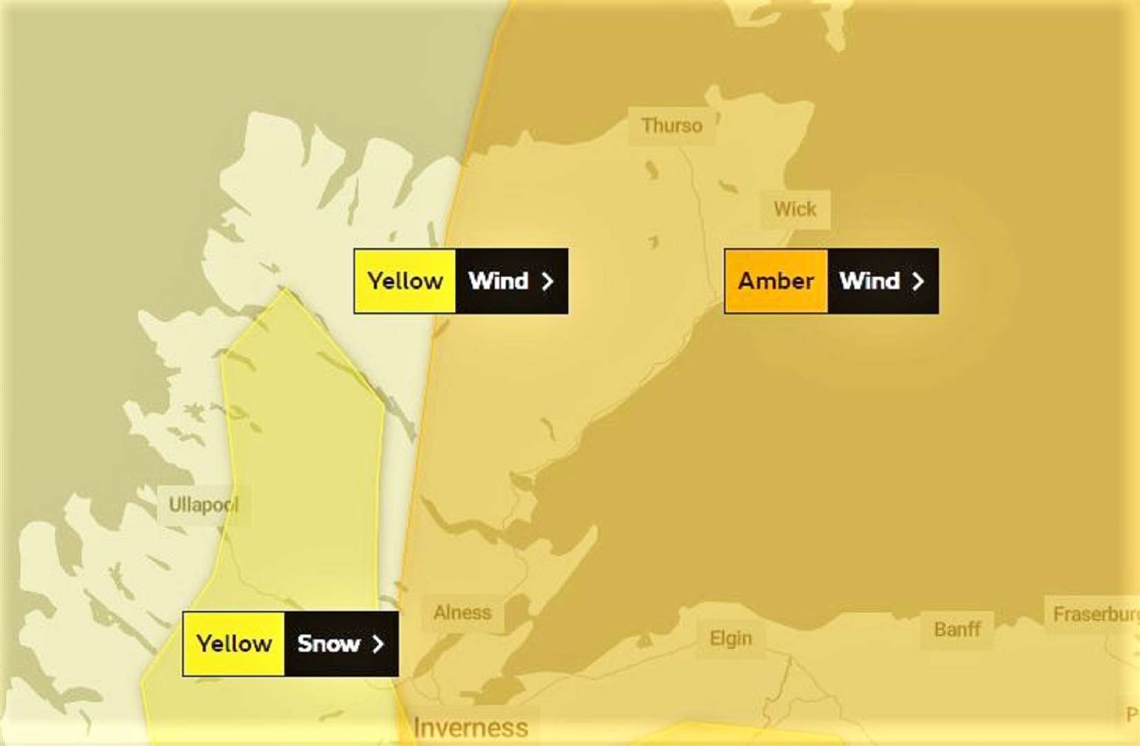
The high winds associated with Storm Arwen are expected to cause some travel disruption and damage.
Snow showers fell in parts of Caithness this morning and the Met Office warns that "spells of hill and mountain snow combined with high winds will give blizzard conditions and cause travel disruption".
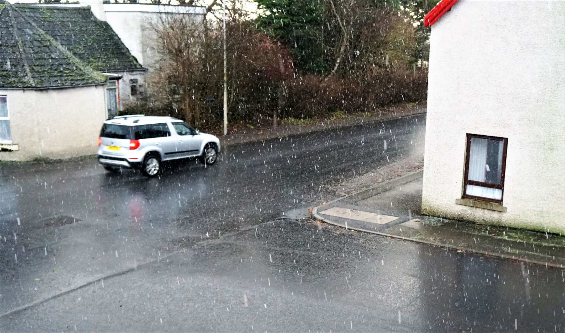
This morning's bulletin said: "Early wintry showers will give way to a spell of more persistent hill and mountain snow during the afternoon and early evening.
"The bulk of snow accumulations will be above 200 to 300 metres and above 300 metres 5 to 8 centimetres snow is possible. Snow will be accompanied by high winds giving blizzard conditions at times and causing some drifting of snow."
What to expect:
- Flying debris is likely and could lead to injuries or danger to life
- Probably damage to trees, temporary structures and buildings, such as tiles blown from roofs
- Longer journey times and cancellations likely, as road, rail, air and ferry services may be affected
- Some roads and bridges likely to close
- There is a good chance that power cuts may occur, with the potential to affect other services, such as mobile phone coverage
- Injuries and danger to life is likely from large waves and beach material being thrown onto coastal roads, sea fronts and properties
Further information can be found at: www.metoffice.gov.uk/weather/warnings-and-advice/uk-warnings